Area Overview for LE3 5GN
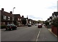
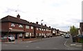
Photos of LE3 5GN


Area Information
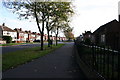
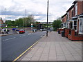
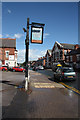
Living in LE3 5GN offers a quiet, residential experience within a small cluster of homes. With a population of 2050, this area is compact but well-served by essential services. The community feels close-knit, with a median age of 47, suggesting a stable demographic of middle-aged and older residents. The area is predominantly home to houses, reflecting a more traditional housing stock. While it lacks the density of larger urban centres, its proximity to rail networks and retail hubs like Aldi Woodgate and Spar provides convenience without the bustle of a city. The absence of major environmental constraints, such as protected woodlands or Areas of Outstanding Natural Beauty, means development is not restricted, though the low flood risk ensures peace of mind. For those seeking a balance between tranquillity and accessibility, LE3 5GN presents a straightforward, practical option.
- Area Type
- Postcode
- Area Size
- Not available
- Population
- 2050
- Population Density
- 9035 people/km²
The property market in LE3 5GN is characterised by a low home ownership rate of 25%, indicating that the majority of properties are likely to be rented rather than owner-occupied. The accommodation type is predominantly houses, which may appeal to families or those seeking more space. Given the small size of the area and the limited number of properties, the market is likely to be competitive, with limited scope for expansion. Buyers should consider that the housing stock is older and may not cater to those seeking modern or high-end developments. The low home ownership rate also suggests that rental demand could be strong, potentially affecting property values and availability for purchase. For those seeking a house in a quiet residential area, LE3 5GN offers a niche opportunity, though it may not suit those prioritising high capital growth.
House Prices in LE3 5GN
No properties found in this postcode.
Energy Efficiency in LE3 5GN
Residents of LE3 5GN have access to a range of nearby amenities, including retail stores like Aldi Woodgate, Spar, and Lidl Fosse Road North. These shops provide daily essentials, reducing the need for long trips. The rail and metro networks connect the area to Leicester, South Wigston, and Rothley, enabling easy access to larger towns and cities. The Leicester Airport, while not a primary travel hub, may cater to occasional travel needs. The presence of multiple retail options and transport links enhances convenience, allowing residents to manage errands and commutes efficiently. However, the area lacks major leisure or entertainment venues, suggesting that residents may need to travel for dining or cultural activities. The lifestyle here is practical, prioritising accessibility over extensive amenities.
Amenities
Schools
Residents of LE3 5GN have access to two primary schools: Fosse Primary School and Fosse Mead Primary Academy. Both are primary institutions, serving children aged 4–11. Fosse Mead Primary Academy holds an Ofsted rating of ‘good’, reflecting its performance in education standards and student outcomes. The presence of two primary schools within practical reach provides families with options, though the absence of secondary schools means students may need to travel further for secondary education. The availability of a ‘good’-rated primary school is a significant advantage for families, as it suggests a reliable foundation for early learning. However, the limited range of educational institutions may be a consideration for those requiring a full spectrum of schooling within the area.
| Rank | School | Type | Entry gender | Ages |
|---|
Explore more schools in this area
Go to Schools tabDemographics
The population of LE3 5GN is 2050, with a median age of 47 and the most common age range being adults aged 30–64. This suggests a community skewed toward middle-aged and older residents, likely with established careers and families. Home ownership in the area is low at 25%, indicating that the majority of residents are likely to be renters. The accommodation type is predominantly houses, which may reflect a preference for standalone properties over flats. The predominant ethnic group is White, though no specific data on diversity or deprivation is provided. The age profile implies a relatively stable population with limited turnover, which can create a consistent local character. However, the low home ownership rate may also suggest limited long-term investment in the area.
Household Size
Accommodation Type
Tenure
Ethnic Group
Religion
Household Composition
Age
Household Deprivation
NS-SEC
Explore more demographic insights in this area
Go to Demographics tabPlanning
Planning Constraints
- Flood RiskPremium
- Ramsar Wetland SitesPremium
- Area of Outstanding Natural BeautyPremium
- Protected Nature ReservePremium
- Protected WoodlandPremium