Area Overview for LE3 5FD
Photos of LE3 5FD
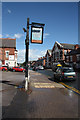
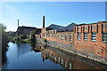
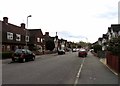
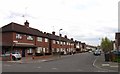

94 photos from this area
Area Information
Key information about the LE3 5FD including its size, population, and administrative classification.
- Area Type
- Postcode
- Area Size
- 5.3 hectares
- Population
- 2395
- Population Density
- 8987 people/km²
House Prices in LE3 5FD
45
Properties
£83,691
Average Sold Price
£25,500
Lowest Price
£155,000
Highest Price
Showing 45 properties
| Address | Type | Beds | Baths | Last Sale Price | Last Sale Date | |
|---|---|---|---|---|---|---|
| 111 Repton Street, Leicester, LE3 5FD | Flat | 2 | 2 | £150,000 | Jul 2025 | |
| 75 Repton Street, Leicester, LE3 5FD | Terraced | 2 | 1 | £155,000 | Jan 2024 | |
| 20 Repton Street, Leicester, LE3 5FD | Semi-detached | 3 | 1 | £148,000 | Dec 2018 | |
| 93 Repton Street, Leicester, LE3 5FD | Terraced | 2 | - | £135,250 | Dec 2018 | |
| 119 Repton Street, Leicester, LE3 5FD | house | 3 | - | £126,500 | Sep 2017 | |
| 123 Repton Street, Leicester, LE3 5FD | Terraced | 2 | 1 | £89,000 | Mar 2016 | |
| 18 Repton Street, Leicester, LE3 5FD | house | - | - | £100,000 | Mar 2016 | |
| 135 Repton Street, Leicester, LE3 5FD | Terraced | 2 | 1 | £80,000 | Apr 2014 | |
| 113 Repton Street, Leicester, LE3 5FD | Terraced | 2 | 1 | £85,000 | Aug 2013 | |
| 9 Repton Street, Leicester, LE3 5FD | house | 3 | - | £115,000 | Jan 2011 |
Page 1 of 5
Energy Efficiency in LE3 5FD
Amenities
Schools
| Rank | School | Type | Entry gender | Ages |
|---|
Explore more schools in this area
Go to Schools tabDemographics
Household Size
One person
most common
Accommodation Type
Houses
most common
Tenure
20
majority
Ethnic Group
White
most common
Religion
N/A
most common
Household Composition
N/A
most common
Age
22
median
Adults (30-64 years)
most common
Household Deprivation
N/A
with no deprivation
NS-SEC
12
in Lower managerial occupations
Explore more demographic insights in this area
Go to Demographics tabPlanning
Planning Constraints
- Flood RiskPremium
- Ramsar Wetland SitesPremium
- Area of Outstanding Natural BeautyPremium
- Protected Nature ReservePremium
- Protected WoodlandPremium