Area Overview for LE3 3RS
Photos of LE3 3RS

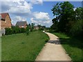


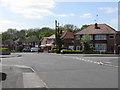

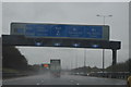
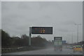

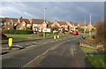

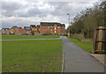
73 photos from this area
Area Information
Key information about the LE3 3RS including its size, population, and administrative classification.
- Area Type
- Postcode
- Area Size
- 1.2 hectares
- Population
- 2286
- Population Density
- 6104 people/km²
House Prices in LE3 3RS
37
Properties
£168,761
Average Sold Price
£52,950
Lowest Price
£297,000
Highest Price
Showing 37 properties
| Address | Type | Beds | Baths | Last Sale Price | Last Sale Date | |
|---|---|---|---|---|---|---|
| 40 Smart Close, Thorpe Astley, Braunstone Town, LE3 3RS | Terraced | 2 | 1 | £210,000 | Dec 2025 | |
| 25 Smart Close, Thorpe Astley, Braunstone Town, LE3 3RS | Semi-detached | 3 | 1 | £249,950 | Jan 2025 | |
| 44 Smart Close, Thorpe Astley, Braunstone Town, LE3 3RS | Detached | 3 | 2 | £297,000 | Nov 2024 | |
| 38 Smart Close, Thorpe Astley, Braunstone Town, LE3 3RS | Terraced | 2 | 1 | £198,000 | Nov 2023 | |
| 8 Smart Close, Thorpe Astley, Braunstone Town, LE3 3RS | Semi-detached | 3 | 1 | £250,000 | Sep 2023 | |
| 1 Smart Close, Thorpe Astley, Braunstone Town, LE3 3RS | Detached | 3 | 2 | £277,000 | Apr 2023 | |
| 34 Smart Close, Thorpe Astley, Braunstone Town, LE3 3RS | Detached | 4 | 4 | £295,000 | Mar 2023 | |
| 42 Smart Close, Thorpe Astley, Braunstone Town, LE3 3RS | Retail | 2 | 1 | £205,000 | May 2022 | |
| 27 Smart Close, Thorpe Astley, Braunstone Town, LE3 3RS | Semi-detached | 2 | 1 | £187,500 | Mar 2022 | |
| 12 Smart Close, Thorpe Astley, Braunstone Town, LE3 3RS | house | 3 | - | £210,000 | Sep 2021 |
Page 1 of 4
Energy Efficiency in LE3 3RS
Amenities
Schools
| Rank | School | Type | Entry gender | Ages |
|---|
Explore more schools in this area
Go to Schools tabDemographics
Household Size
Family (3-5 people)
most common
Accommodation Type
Houses
most common
Tenure
66
majority
Ethnic Group
White
most common
Religion
N/A
most common
Household Composition
N/A
most common
Age
47
median
Adults (30-64 years)
most common
Household Deprivation
N/A
with no deprivation
NS-SEC
34
in Lower managerial occupations
Explore more demographic insights in this area
Go to Demographics tabPlanning
Planning Constraints
- Flood RiskPremium
- Ramsar Wetland SitesPremium
- Area of Outstanding Natural BeautyPremium
- Protected Nature ReservePremium
- Protected WoodlandPremium