Area Overview for LE3 3DU
Photos of LE3 3DU

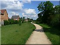

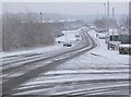
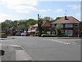

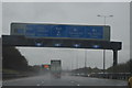
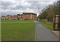
73 photos from this area
Area Information
Key information about the LE3 3DU including its size, population, and administrative classification.
- Area Type
- Postcode
- Area Size
- 1.4 hectares
- Population
- 2286
- Population Density
- 6104 people/km²
House Prices in LE3 3DU
41
Properties
£154,557
Average Sold Price
£86,950
Lowest Price
£280,000
Highest Price
Showing 41 properties
| Address | Type | Beds | Baths | Last Sale Price | Last Sale Date | |
|---|---|---|---|---|---|---|
| 54 Westover Road, Braunstone Town, LE3 3DU | Semi-detached | 3 | 1 | £280,000 | Feb 2024 | |
| 39 Westover Road, Braunstone Town, LE3 3DU | house | - | - | £226,000 | Jan 2022 | |
| 56 Westover Road, Braunstone Town, LE3 3DU | Semi-detached | 3 | 1 | £132,000 | Jul 2019 | |
| 48 Westover Road, Braunstone Town, LE3 3DU | Semi-detached | 3 | 1 | £183,000 | Apr 2019 | |
| 73 Westover Road, Braunstone Town, LE3 3DU | Semi-detached | 3 | 1 | £158,500 | Apr 2019 | |
| 38 Westover Road, Braunstone Town, LE3 3DU | Semi-detached | 3 | 1 | £189,950 | Jan 2019 | |
| 71 Westover Road, Braunstone Town, LE3 3DU | Semi-detached | 5 | - | £165,000 | May 2016 | |
| 55 Westover Road, Braunstone Town, LE3 3DU | Semi-detached | 3 | - | £125,000 | Dec 2013 | |
| 43 Westover Road, Braunstone Town, LE3 3DU | house | 3 | - | £133,000 | Mar 2012 | |
| 65 Westover Road, Braunstone Town, LE3 3DU | house | - | - | £130,000 | Apr 2009 |
Page 1 of 5
Energy Efficiency in LE3 3DU
Amenities
Schools
| Rank | School | Type | Entry gender | Ages |
|---|
Explore more schools in this area
Go to Schools tabDemographics
Household Size
Family (3-5 people)
most common
Accommodation Type
Houses
most common
Tenure
66
majority
Ethnic Group
White
most common
Religion
N/A
most common
Household Composition
N/A
most common
Age
47
median
Adults (30-64 years)
most common
Household Deprivation
N/A
with no deprivation
NS-SEC
34
in Lower managerial occupations
Explore more demographic insights in this area
Go to Demographics tabPlanning
Planning Constraints
- Flood RiskPremium
- Ramsar Wetland SitesPremium
- Area of Outstanding Natural BeautyPremium
- Protected Nature ReservePremium
- Protected WoodlandPremium