Area Overview for LE3 3DD
Photos of LE3 3DD
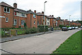
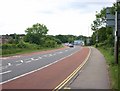
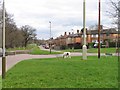
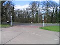
51 photos from this area
Area Information
Key information about the LE3 3DD including its size, population, and administrative classification.
- Area Type
- Postcode
- Area Size
- 1.8 hectares
- Population
- 1760
- Population Density
- 3271 people/km²
House Prices in LE3 3DD
44
Properties
£151,525
Average Sold Price
£36,000
Lowest Price
£282,500
Highest Price
Showing 44 properties
| Address | Type | Beds | Baths | Last Sale Price | Last Sale Date | |
|---|---|---|---|---|---|---|
| 437 Braunstone Lane, Leicester, LE3 3DD | Semi-detached | 3 | 2 | £282,500 | Feb 2025 | |
| 389 Braunstone Lane, Leicester, LE3 3DD | Retail | 3 | 1 | £271,000 | Oct 2022 | |
| 423 Braunstone Lane, Leicester, LE3 3DD | house | - | - | £70,800 | Aug 2021 | |
| 391 Braunstone Lane, Leicester, LE3 3DD | Semi-detached | 3 | 1 | £190,000 | Jul 2020 | |
| 433 Braunstone Lane, Leicester, LE3 3DD | Semi-detached | 3 | 1 | £174,000 | Feb 2020 | |
| 421 Braunstone Lane, Leicester, LE3 3DD | house | - | - | £160,000 | Feb 2020 | |
| 383 Braunstone Lane, Leicester, LE3 3DD | house | - | - | £130,000 | Feb 2019 | |
| 425 Braunstone Lane, Leicester, LE3 3DD | Semi-detached | 3 | 1 | £119,000 | Aug 2017 | |
| 399 Braunstone Lane, Leicester, LE3 3DD | Semi-detached | 4 | 1 | £130,000 | Dec 2016 | |
| 457 Braunstone Lane, Leicester, LE3 3DD | Bungalow | 3 | - | £160,000 | Sep 2015 |
Page 1 of 5
Energy Efficiency in LE3 3DD
Amenities
Schools
| Rank | School | Type | Entry gender | Ages |
|---|
Explore more schools in this area
Go to Schools tabDemographics
Household Size
Family (3-5 people)
most common
Accommodation Type
Houses
most common
Tenure
23
majority
Ethnic Group
White
most common
Religion
N/A
most common
Household Composition
N/A
most common
Age
47
median
Adults (30-64 years)
most common
Household Deprivation
N/A
with no deprivation
NS-SEC
9
in Lower managerial occupations
Explore more demographic insights in this area
Go to Demographics tabPlanning
Planning Constraints
- Flood RiskPremium
- Ramsar Wetland SitesPremium
- Area of Outstanding Natural BeautyPremium
- Protected Nature ReservePremium
- Protected WoodlandPremium