Area Overview for LE3 2SU
Photos of LE3 2SU
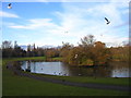
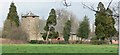
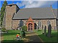
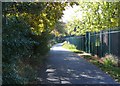
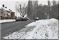

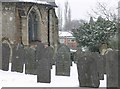
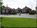
100 photos from this area
Area Information
Key information about the LE3 2SU including its size, population, and administrative classification.
- Area Type
- Postcode
- Area Size
- 1.2 hectares
- Population
- 1616
- Population Density
- 5186 people/km²
House Prices in LE3 2SU
26
Properties
£152,175
Average Sold Price
£43,000
Lowest Price
£271,000
Highest Price
Showing 26 properties
| Address | Type | Beds | Baths | Last Sale Price | Last Sale Date | |
|---|---|---|---|---|---|---|
| 6 Stratford Road, Braunstone Town, LE3 2SU | Semi-detached | 3 | 1 | £271,000 | Feb 2025 | |
| 22 Stratford Road, Braunstone Town, LE3 2SU | house | - | - | £220,000 | Aug 2022 | |
| 32 Stratford Road, Braunstone Town, LE3 2SU | house | 3 | - | £196,000 | Apr 2021 | |
| 50 Stratford Road, Braunstone Town, LE3 2SU | house | - | - | £212,000 | Apr 2021 | |
| 18 Stratford Road, Braunstone Town, LE3 2SU | Semi-detached | 3 | 1 | £190,000 | Mar 2021 | |
| 42 Stratford Road, Braunstone Town, LE3 2SU | Semi-detached | 3 | 1 | £145,000 | Dec 2018 | |
| 44 Stratford Road, Braunstone Town, LE3 2SU | Semi-detached | 3 | 1 | £156,000 | Jan 2018 | |
| 4 Stratford Road, Braunstone Town, LE3 2SU | Semi-detached | 3 | 1 | £165,000 | Aug 2017 | |
| 12 Stratford Road, Braunstone Town, LE3 2SU | Semi-detached | 3 | - | £135,000 | Apr 2013 | |
| 36 Stratford Road, Braunstone Town, LE3 2SU | house | 3 | - | £125,000 | Dec 2010 |
Page 1 of 3
Energy Efficiency in LE3 2SU
Amenities
Schools
| Rank | School | Type | Entry gender | Ages |
|---|
Explore more schools in this area
Go to Schools tabDemographics
Household Size
Family (3-5 people)
most common
Accommodation Type
Houses
most common
Tenure
69
majority
Ethnic Group
White
most common
Religion
N/A
most common
Household Composition
N/A
most common
Age
47
median
Adults (30-64 years)
most common
Household Deprivation
N/A
with no deprivation
NS-SEC
21
in Lower managerial occupations
Explore more demographic insights in this area
Go to Demographics tabPlanning
Planning Constraints
- Flood RiskPremium
- Ramsar Wetland SitesPremium
- Area of Outstanding Natural BeautyPremium
- Protected Nature ReservePremium
- Protected WoodlandPremium