Area Overview for LE3 0US
Photos of LE3 0US
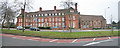
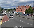
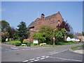
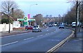
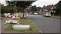
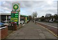
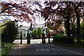
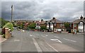
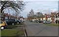
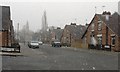
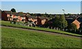
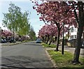
41 photos from this area
Area Information
Key information about the LE3 0US including its size, population, and administrative classification.
- Area Type
- Postcode
- Area Size
- 1.6 hectares
- Population
- 1513
- Population Density
- 5890 people/km²
House Prices in LE3 0US
34
Properties
£162,541
Average Sold Price
£47,000
Lowest Price
£290,000
Highest Price
Showing 34 properties
| Address | Type | Beds | Baths | Last Sale Price | Last Sale Date | |
|---|---|---|---|---|---|---|
| 46 Wyngate Drive, Leicester, LE3 0US | Semi-detached | 3 | 1 | £285,000 | Oct 2025 | |
| 12 Wyngate Drive, Leicester, LE3 0US | Semi-detached | 4 | 1 | £290,000 | Jun 2023 | |
| 50 Wyngate Drive, Leicester, LE3 0US | Semi-detached | 4 | 1 | £234,000 | Sep 2019 | |
| 14 Wyngate Drive, Leicester, LE3 0US | house | - | - | £162,500 | May 2018 | |
| 40 Wyngate Drive, Leicester, LE3 0US | house | - | - | £178,000 | Mar 2018 | |
| 54 Wyngate Drive, Leicester, LE3 0US | house | - | - | £216,000 | Feb 2018 | |
| 6 Wyngate Drive, Leicester, LE3 0US | Semi-detached | 3 | 2 | £175,000 | Sep 2016 | |
| 18 Wyngate Drive, Leicester, LE3 0US | Semi-detached | 3 | 1 | £155,250 | Jun 2016 | |
| 36 Wyngate Drive, Leicester, LE3 0US | Semi-detached | 3 | 1 | £152,500 | Aug 2013 | |
| 30 Wyngate Drive, Leicester, LE3 0US | Semi-detached | 3 | - | £124,950 | Jul 2010 |
Page 1 of 4
Energy Efficiency in LE3 0US
Amenities
Schools
| Rank | School | Type | Entry gender | Ages |
|---|
Explore more schools in this area
Go to Schools tabDemographics
Household Size
Family (3-5 people)
most common
Accommodation Type
Houses
most common
Tenure
81
majority
Ethnic Group
White
most common
Religion
N/A
most common
Household Composition
N/A
most common
Age
47
median
Adults (30-64 years)
most common
Household Deprivation
N/A
with no deprivation
NS-SEC
39
in Lower managerial occupations
Explore more demographic insights in this area
Go to Demographics tabPlanning
Planning Constraints
- Flood RiskPremium
- Ramsar Wetland SitesPremium
- Area of Outstanding Natural BeautyPremium
- Protected Nature ReservePremium
- Protected WoodlandPremium