Area Overview for LE3 0JZ
Photos of LE3 0JZ
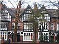
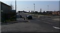
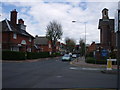
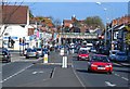
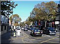
100 photos from this area
Area Information
Key information about the LE3 0JZ including its size, population, and administrative classification.
- Area Type
- Postcode
- Area Size
- 4845 m²
- Population
- 1337
- Population Density
- 9985 people/km²
House Prices in LE3 0JZ
36
Properties
£145,183
Average Sold Price
£48,500
Lowest Price
£236,000
Highest Price
Showing 36 properties
| Address | Type | Beds | Baths | Last Sale Price | Last Sale Date | |
|---|---|---|---|---|---|---|
| 121 Harrow Road, Leicester, LE3 0JZ | Terraced | 2 | 1 | £180,000 | Jun 2025 | |
| 177 Harrow Road, Leicester, LE3 0JZ | Terraced | 3 | 1 | £187,000 | Feb 2025 | |
| 175 Harrow Road, Leicester, LE3 0JZ | Terraced | 3 | 1 | £235,000 | Mar 2024 | |
| 159 Harrow Road, Leicester, LE3 0JZ | Terraced | 2 | 1 | £236,000 | Aug 2022 | |
| 123 Harrow Road, Leicester, LE3 0JZ | house | - | - | £200,000 | Feb 2022 | |
| 165 Harrow Road, Leicester, LE3 0JZ | Terraced | 2 | 1 | £181,000 | Aug 2020 | |
| 153 Harrow Road, Leicester, LE3 0JZ | house | - | - | £205,000 | Jun 2020 | |
| 151 Harrow Road, Leicester, LE3 0JZ | house | - | - | £183,000 | Jan 2020 | |
| 125 Harrow Road, Leicester, LE3 0JZ | Terraced | 2 | 1 | £170,000 | Jun 2019 | |
| 147 Harrow Road, Leicester, LE3 0JZ | Terraced | 2 | 1 | £175,000 | Apr 2019 |
Page 1 of 4
Energy Efficiency in LE3 0JZ
Amenities
Schools
| Rank | School | Type | Entry gender | Ages |
|---|
Explore more schools in this area
Go to Schools tabDemographics
Household Size
Family (3-5 people)
most common
Accommodation Type
Houses
most common
Tenure
46
majority
Ethnic Group
White
most common
Religion
N/A
most common
Household Composition
N/A
most common
Age
47
median
Adults (30-64 years)
most common
Household Deprivation
N/A
with no deprivation
NS-SEC
24
in Lower managerial occupations
Explore more demographic insights in this area
Go to Demographics tabPlanning
Planning Constraints
- Flood RiskPremium
- Ramsar Wetland SitesPremium
- Area of Outstanding Natural BeautyPremium
- Protected Nature ReservePremium
- Protected WoodlandPremium