Area Overview for LE3 0GP
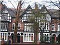
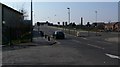
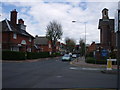
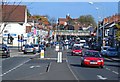
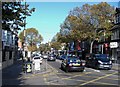
Photos of LE3 0GP
Area Information
Living in LE3 0GP offers a compact, residential experience shaped by its small cluster of homes and proximity to key services. With a population of 1,935, the area is characterised by a youthful demographic, reflecting its appeal to young adults. The postcode’s limited size means it is tightly integrated with nearby amenities, including retail hubs like Tesco Leicester and Morrisons, which cater to daily needs. Residents benefit from strong transport links, with three railway stations—Leicester, South Wigston, and Syston—offering connections to major cities and towns. The broadband score of 98 ensures seamless online connectivity, supporting remote work or entertainment. While the area lacks natural landscapes, its practicality and accessibility make it suitable for those prioritising convenience. The presence of King Richard III Infant and Nursery School adds to its family-friendly appeal, though the school’s Ofsted rating of satisfactory indicates room for improvement. LE3 0GP is not a place for those seeking sprawling green spaces, but it is ideal for those valuing efficiency, affordability, and proximity to urban infrastructure.
- Area Type
- Postcode
- Area Size
- Not available
- Population
- 1935
- Population Density
- 11356 people/km²
The property market in LE3 0GP is defined by its low home ownership rate of 23%, indicating that the majority of housing stock is rented. Flats dominate the accommodation type, reflecting a focus on smaller, manageable units suited to young adults and students. This suggests the area is not a traditional owner-occupied neighbourhood but rather one catering to renters seeking affordability and proximity to services. The limited population size and small footprint mean the housing stock is unlikely to expand significantly, which could create competition for available properties. For buyers, this presents challenges: the scarcity of owner-occupied homes may make it difficult to find a purchase, and the area’s small size limits the availability of new developments. However, the proximity to Leicester’s rail network and retail hubs could offset these drawbacks, making LE3 0GP an attractive option for those prioritising location over property investment potential.
House Prices in LE3 0GP
No properties found in this postcode.
Energy Efficiency in LE3 0GP
Daily life in LE3 0GP is shaped by its proximity to retail and transport hubs. Residents have access to five notable retail outlets, including Tesco Leicester and Morrisons, providing essential shopping and dining options. The three railway stations—Leicester, South Wigston, and Syston—offer easy access to cultural, professional, and leisure opportunities in nearby towns. The Leicester Airport, though modest, adds to the area’s connectivity. While the area lacks parks or green spaces, its practicality is evident in the availability of basic amenities. The presence of King Richard III Infant and Nursery School ensures families can access early education without long commutes. The combination of retail, transport, and nearby services creates a functional lifestyle, ideal for those prioritising convenience over expansive natural environments.
Amenities
Schools
The nearest school to LE3 0GP is King Richard III Infant and Nursery School, a primary institution with an Ofsted rating of satisfactory. This school serves the local community, offering education for younger children, but its rating suggests it meets minimum standards without standing out for excellence. The absence of secondary schools in the immediate area means families may need to look further afield for comprehensive education. For parents, this implies a reliance on nearby towns or schools outside LE3 0GP for older children. The single primary school available reflects the area’s small size, which limits the diversity of educational options. While the school provides a basic service, its performance highlights the need for additional investment or alternative provisions for families requiring higher academic standards.
| Rank | School | Type | Entry gender | Ages |
|---|
Explore more schools in this area
Go to Schools tabDemographics
The community in LE3 0GP is predominantly young, with a median age of 22 and the majority of residents aged 15–29. This reflects a population skewed towards students, early-career professionals, or those in transitional life stages. Home ownership is low at 23%, suggesting that most residents rent their flats, which are the primary accommodation type in the area. The predominant ethnic group is White, though specific data on diversity is not provided. The youthful age profile implies a dynamic, possibly transient population, with needs centred on affordability and access to services. The lack of high home ownership rates may indicate a rental market dominated by private landlords or housing associations. For buyers, this suggests limited opportunities for property investment, but it also means the area is likely to remain competitive for renters. The absence of detailed deprivation data means the quality of life cannot be fully assessed, but the presence of basic amenities and transport links hints at a functional, if modest, living environment.
Household Size
Accommodation Type
Tenure
Ethnic Group
Religion
Household Composition
Age
Household Deprivation
NS-SEC
Explore more demographic insights in this area
Go to Demographics tabPlanning
Planning Constraints
- Flood RiskPremium
- Ramsar Wetland SitesPremium
- Area of Outstanding Natural BeautyPremium
- Protected Nature ReservePremium
- Protected WoodlandPremium