Area Overview for LE2 8PL
Photos of LE2 8PL
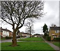
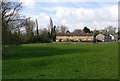
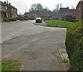
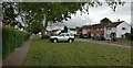
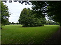
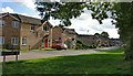
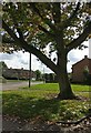
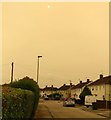
33 photos from this area
Area Information
Key information about the LE2 8PL including its size, population, and administrative classification.
- Area Type
- Postcode
- Area Size
- 3.1 hectares
- Population
- 1670
- Population Density
- 3048 people/km²
House Prices in LE2 8PL
31
Properties
£312,295
Average Sold Price
£108,000
Lowest Price
£567,000
Highest Price
Showing 31 properties
| Address | Type | Beds | Baths | Last Sale Price | Last Sale Date | |
|---|---|---|---|---|---|---|
| 143 Lutterworth Road, Leicester, LE2 8PL | Semi-detached | 3 | 1 | £380,000 | Jul 2024 | |
| 141 Lutterworth Road, Leicester, LE2 8PL | house | - | - | £395,000 | Nov 2021 | |
| 91 Lutterworth Road, Leicester, LE2 8PL | Detached | 4 | 2 | £560,000 | Mar 2021 | |
| 95 Lutterworth Road, Leicester, LE2 8PL | house | 4 | - | £445,000 | Mar 2021 | |
| Former, 97 Lutterworth Road, Leicester, LE2 8PL | Detached | 5 | 3 | £415,000 | Mar 2021 | |
| 135 Lutterworth Road, Leicester, LE2 8PL | house | - | - | £430,000 | Aug 2020 | |
| 139 Lutterworth Road, Leicester, LE2 8PL | Detached | 5 | - | £380,000 | Oct 2016 | |
| 123 Lutterworth Road, Leicester, LE2 8PL | Detached | 6 | - | £370,000 | Jan 2016 | |
| 127 Lutterworth Road, Leicester, LE2 8PL | Detached | 3 | - | £290,000 | Sep 2014 | |
| 119 Lutterworth Road, Leicester, LE2 8PL | Detached | 4 | 2 | £300,000 | Sep 2014 |
Page 1 of 4
Energy Efficiency in LE2 8PL
Amenities
Schools
| Rank | School | Type | Entry gender | Ages |
|---|
Explore more schools in this area
Go to Schools tabDemographics
Household Size
Family (3-5 people)
most common
Accommodation Type
Houses
most common
Tenure
62
majority
Ethnic Group
White
most common
Religion
N/A
most common
Household Composition
N/A
most common
Age
47
median
Adults (30-64 years)
most common
Household Deprivation
N/A
with no deprivation
NS-SEC
25
in Lower managerial occupations
Explore more demographic insights in this area
Go to Demographics tabPlanning
Planning Constraints
- Flood RiskPremium
- Ramsar Wetland SitesPremium
- Area of Outstanding Natural BeautyPremium
- Protected Nature ReservePremium
- Protected WoodlandPremium