Area Overview for LE2 8PA
Photos of LE2 8PA
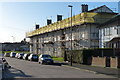
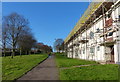
57 photos from this area
Area Information
Key information about the LE2 8PA including its size, population, and administrative classification.
- Area Type
- Postcode
- Area Size
- 4.6 hectares
- Population
- 1586
- Population Density
- 4799 people/km²
House Prices in LE2 8PA
57
Properties
£203,966
Average Sold Price
£65,000
Lowest Price
£365,000
Highest Price
Showing 57 properties
| Address | Type | Beds | Baths | Last Sale Price | Last Sale Date | |
|---|---|---|---|---|---|---|
| 50 Belvoir Drive, Leicester, LE2 8PA | Semi-detached | 3 | 1 | £322,500 | Oct 2023 | |
| 36 Belvoir Drive, Leicester, LE2 8PA | Terraced | 3 | 1 | £237,000 | Jun 2021 | |
| 18 Belvoir Drive, Leicester, LE2 8PA | house | - | - | £365,000 | Jul 2019 | |
| 38 Belvoir Drive, Leicester, LE2 8PA | Terraced | 3 | 1 | £221,000 | Aug 2018 | |
| 66 Belvoir Drive, Leicester, LE2 8PA | house | 3 | 1 | £197,000 | Dec 2017 | |
| 34 Belvoir Drive, Leicester, LE2 8PA | Terraced | - | - | £210,000 | Nov 2016 | |
| 54 Belvoir Drive, Leicester, LE2 8PA | house | 3 | - | £218,000 | Aug 2016 | |
| 30 Belvoir Drive, Leicester, LE2 8PA | Detached | 4 | - | £327,000 | May 2016 | |
| 42 Belvoir Drive, Leicester, LE2 8PA | Detached | 3 | - | £250,000 | Jun 2012 | |
| 26 Belvoir Drive, Leicester, LE2 8PA | Semi-detached | 3 | 1 | £142,500 | Nov 2011 |
Page 1 of 6
Energy Efficiency in LE2 8PA
Amenities
Schools
| Rank | School | Type | Entry gender | Ages |
|---|
Explore more schools in this area
Go to Schools tabDemographics
Household Size
Family (3-5 people)
most common
Accommodation Type
Houses
most common
Tenure
81
majority
Ethnic Group
White
most common
Religion
N/A
most common
Household Composition
N/A
most common
Age
47
median
Adults (30-64 years)
most common
Household Deprivation
N/A
with no deprivation
NS-SEC
25
in Lower managerial occupations
Explore more demographic insights in this area
Go to Demographics tabPlanning
Planning Constraints
- Flood RiskPremium
- Ramsar Wetland SitesPremium
- Area of Outstanding Natural BeautyPremium
- Protected Nature ReservePremium
- Protected WoodlandPremium