Area Overview for LE2 7DB
Photos of LE2 7DB
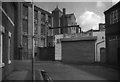
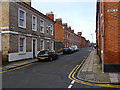

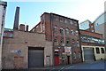
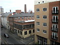
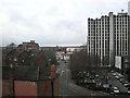
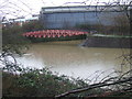
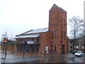
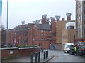
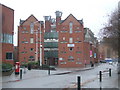
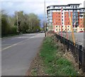

100 photos from this area
Area Information
Key information about the LE2 7DB including its size, population, and administrative classification.
- Area Type
- Postcode
- Area Size
- 3611 m²
- Population
- 3529
- Population Density
- 12061 people/km²
House Prices in LE2 7DB
28
Properties
£102,845
Average Sold Price
£33,000
Lowest Price
£180,000
Highest Price
Showing 28 properties
| Address | Type | Beds | Baths | Last Sale Price | Last Sale Date | |
|---|---|---|---|---|---|---|
| 65 Grasmere Street, Leicester, LE2 7DB | Terraced | 2 | 1 | £180,000 | Nov 2025 | |
| 95 Grasmere Street, Leicester, LE2 7DB | Terraced | 3 | - | £145,000 | May 2020 | |
| 81 Grasmere Street, Leicester, LE2 7DB | house | 3 | - | £153,000 | Jan 2019 | |
| 63 Grasmere Street, Leicester, LE2 7DB | Terraced | 4 | 1 | £120,500 | Feb 2015 | |
| 79 Grasmere Street, Leicester, LE2 7DB | Terraced | 2 | 2 | £108,500 | Jan 2013 | |
| 53 Grasmere Street, Leicester, LE2 7DB | Terraced | 3 | - | £100,000 | Feb 2012 | |
| 89 Grasmere Street, Leicester, LE2 7DB | Terraced | 4 | 1 | £98,000 | Jul 2011 | |
| 61 Grasmere Street, Leicester, LE2 7DB | Terraced | 3 | 1 | £119,313 | Sep 2006 | |
| 45 Grasmere Street, Leicester, LE2 7DB | Terraced | 3 | 2 | £134,000 | Apr 2006 | |
| 57 Grasmere Street, Leicester, LE2 7DB | Detached | 4 | 2 | £100,000 | Jan 2004 |
Page 1 of 3
Energy Efficiency in LE2 7DB
Amenities
Schools
| Rank | School | Type | Entry gender | Ages |
|---|
Explore more schools in this area
Go to Schools tabDemographics
Household Size
Family (3-5 people)
most common
Accommodation Type
Houses
most common
Tenure
14
majority
Ethnic Group
White
most common
Religion
N/A
most common
Household Composition
N/A
most common
Age
22
median
Young Adults (15-29 years)
most common
Household Deprivation
N/A
with no deprivation
NS-SEC
10
in Lower managerial occupations
Explore more demographic insights in this area
Go to Demographics tabPlanning
Planning Constraints
- Flood RiskPremium
- Ramsar Wetland SitesPremium
- Area of Outstanding Natural BeautyPremium
- Protected Nature ReservePremium
- Protected WoodlandPremium