Area Overview for LE2 6FZ
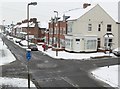
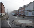
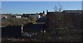
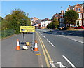
Photos of LE2 6FZ


Area Information
Living in LE2 6FZ means being part of a small, tightly knit residential cluster in England, home to 2,323 residents. This area is characterised by its compact size and proximity to essential services, making it practical for daily life. The community is predominantly made up of adults aged 30–64, with a median age of 22, suggesting a mix of younger professionals and families. The area’s housing stock is largely composed of homes, with 45% of residents owning their properties. While the population is small, the presence of nearby amenities such as Spar, Tesco Leicester, and Leicester Railway Station ensures convenience. Digital connectivity is robust, with broadband rated at 100 (excellent) and mobile coverage at 85 (good). However, the area’s safety profile is mixed: flood risk is negligible, but crime risk is high, with a score of 29. Despite this, LE2 6FZ offers a straightforward, no-frills lifestyle for those prioritising accessibility over luxury. Its compact nature means residents can reach key destinations quickly, though the high crime score warrants caution. For buyers seeking a practical, low-maintenance base, this area provides a clear, if modest, foundation.
- Area Type
- Postcode
- Area Size
- Not available
- Population
- 2323
- Population Density
- 3623 people/km²
The property market in LE2 6FZ is defined by its 45% home ownership rate, indicating that the majority of residents rent rather than own their homes. This suggests a rental-focused market, which may influence property values and availability. The accommodation type is predominantly houses, reinforcing a residential character rather than a mix of flats or apartments. For buyers, this means the area is unlikely to offer high-density housing options, and properties are likely to be larger, single-family homes. The small population and compact nature of the area mean the housing stock is limited, with little scope for new developments. This could make the market competitive for those seeking to purchase, particularly if the area’s appeal aligns with its practical, no-frills nature. Buyers should consider the high crime risk, which may affect property desirability, though the absence of planning constraints such as protected woodlands or AONB designations could simplify transactions. Overall, the market is niche, catering to those prioritising convenience over premium features.
House Prices in LE2 6FZ
No properties found in this postcode.
Energy Efficiency in LE2 6FZ
Residents of LE2 6FZ have access to a range of nearby amenities that support daily life. Retail options include Spar, Heron Aylestone, and Tesco Leicester, providing essential shopping and dining choices. The area’s proximity to Leicester Railway Station and South Wigston Railway Station ensures easy access to public transport, while Leicester North and Great Central Railway metro stations offer additional connectivity. Leicester Airport is within practical reach, though its role is more regional than international. While the data does not mention parks or leisure facilities, the absence of protected natural areas suggests limited green spaces. The convenience of nearby retail and transport hubs makes daily routines efficient, though the area’s small size means options are not extensive. For those prioritising accessibility over luxury, LE2 6FZ offers a straightforward, functional lifestyle with minimal effort required to access services.
Amenities
Schools
| Rank | School | Type | Entry gender | Ages |
|---|
Explore more schools in this area
Go to Schools tabDemographics
The community in LE2 6FZ is primarily composed of adults aged 30–64, with a median age of 22, indicating a balance between younger professionals and established households. Home ownership stands at 45%, meaning most residents rent their homes, which shapes the local economy and social dynamics. The predominant accommodation type is houses, reflecting a residential focus rather than high-density living. The population is overwhelmingly White, with no specific data on other ethnic groups provided. This homogeneity may influence the area’s cultural and social character. The age profile suggests a stable, working-age population, though the relatively low median age compared to the most common age range hints at a mix of life stages. Deprivation data is not explicitly stated, but the 45% home ownership rate implies a rental-heavy market, which can affect long-term stability for residents. The area’s small size and limited diversity may appeal to those seeking a straightforward, predictable community.
Household Size
Accommodation Type
Tenure
Ethnic Group
Religion
Household Composition
Age
Household Deprivation
NS-SEC
Explore more demographic insights in this area
Go to Demographics tabPlanning
Planning Constraints
- Flood RiskPremium
- Ramsar Wetland SitesPremium
- Area of Outstanding Natural BeautyPremium
- Protected Nature ReservePremium
- Protected WoodlandPremium