Area Overview for LE2 6FT
Photos of LE2 6FT


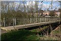
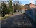
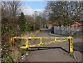
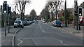
98 photos from this area
Area Information
Key information about the LE2 6FT including its size, population, and administrative classification.
- Area Type
- Postcode
- Area Size
- 5.3 hectares
- Population
- 1638
- Population Density
- 3218 people/km²
House Prices in LE2 6FT
28
Properties
£161,737
Average Sold Price
£43,500
Lowest Price
£330,000
Highest Price
Showing 28 properties
| Address | Type | Beds | Baths | Last Sale Price | Last Sale Date | |
|---|---|---|---|---|---|---|
| 121 Knighton Lane East, Leicester, LE2 6FT | Semi-detached | 3 | 1 | £315,000 | Mar 2025 | |
| 125 Knighton Lane East, Leicester, LE2 6FT | Semi-detached | 4 | 2 | £227,500 | Aug 2024 | |
| 153 Knighton Lane East, Leicester, LE2 6FT | Semi-detached | 3 | 1 | £330,000 | Feb 2024 | |
| 131 Knighton Lane East, Leicester, LE2 6FT | Semi-detached | 3 | 1 | £260,000 | Feb 2024 | |
| 115 Knighton Lane East, Leicester, LE2 6FT | Semi-detached | 3 | 1 | £242,500 | Feb 2023 | |
| 103 Knighton Lane East, Leicester, LE2 6FT | Semi-detached | 3 | - | £277,500 | Dec 2022 | |
| 105 Knighton Lane East, Leicester, LE2 6FT | Semi-detached | 3 | 1 | £295,000 | May 2022 | |
| 127 Knighton Lane East, Leicester, LE2 6FT | house | - | - | £190,000 | Nov 2020 | |
| 133 Knighton Lane East, Leicester, LE2 6FT | Semi-detached | 3 | 1 | £192,000 | May 2019 | |
| 109 Knighton Lane East, Leicester, LE2 6FT | Semi-detached | 3 | 1 | £180,000 | Jan 2017 |
Page 1 of 3
Energy Efficiency in LE2 6FT
Amenities
Schools
| Rank | School | Type | Entry gender | Ages |
|---|
Explore more schools in this area
Go to Schools tabDemographics
Household Size
Family (3-5 people)
most common
Accommodation Type
Houses
most common
Tenure
64
majority
Ethnic Group
White
most common
Religion
N/A
most common
Household Composition
N/A
most common
Age
47
median
Adults (30-64 years)
most common
Household Deprivation
N/A
with no deprivation
NS-SEC
34
in Lower managerial occupations
Explore more demographic insights in this area
Go to Demographics tabPlanning
Planning Constraints
- Flood RiskPremium
- Ramsar Wetland SitesPremium
- Area of Outstanding Natural BeautyPremium
- Protected Nature ReservePremium
- Protected WoodlandPremium