Area Overview for LE2 6FJ
Photos of LE2 6FJ
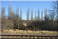
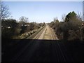
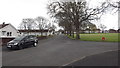
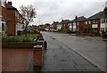
44 photos from this area
Area Information
Key information about the LE2 6FJ including its size, population, and administrative classification.
- Area Type
- Postcode
- Area Size
- 1.2 hectares
- Population
- 1649
- Population Density
- 6586 people/km²
House Prices in LE2 6FJ
32
Properties
£181,341
Average Sold Price
£45,000
Lowest Price
£356,000
Highest Price
Showing 32 properties
| Address | Type | Beds | Baths | Last Sale Price | Last Sale Date | |
|---|---|---|---|---|---|---|
| 55 Northdene Road, Leicester, LE2 6FJ | Semi-detached | 3 | 1 | £320,000 | Apr 2024 | |
| 45 Northdene Road, Leicester, LE2 6FJ | Semi-detached | 4 | 1 | £325,000 | Mar 2023 | |
| 23 Northdene Road, Leicester, LE2 6FJ | Retail | 4 | 1 | £356,000 | Aug 2022 | |
| 53 Northdene Road, Leicester, LE2 6FJ | Semi-detached | 3 | - | £300,000 | Nov 2021 | |
| 57 Northdene Road, Leicester, LE2 6FJ | house | - | - | £330,000 | Dec 2020 | |
| 11 Northdene Road, Leicester, LE2 6FJ | Semi-detached | 3 | 1 | £225,000 | Jun 2018 | |
| 7 Northdene Road, Leicester, LE2 6FJ | Semi-detached | 3 | 1 | £195,000 | Mar 2018 | |
| 37 Northdene Road, Leicester, LE2 6FJ | Semi-detached | 3 | 1 | £195,000 | Jan 2018 | |
| 35 Northdene Road, Leicester, LE2 6FJ | Semi-detached | 3 | 1 | £177,500 | Feb 2016 | |
| 63 Northdene Road, Leicester, LE2 6FJ | Detached | 3 | - | £170,000 | Apr 2014 |
Page 1 of 4
Energy Efficiency in LE2 6FJ
Amenities
Schools
| Rank | School | Type | Entry gender | Ages |
|---|
Explore more schools in this area
Go to Schools tabDemographics
Household Size
Family (3-5 people)
most common
Accommodation Type
Houses
most common
Tenure
80
majority
Ethnic Group
asian_total
most common
Religion
N/A
most common
Household Composition
N/A
most common
Age
47
median
Adults (30-64 years)
most common
Household Deprivation
N/A
with no deprivation
NS-SEC
29
in Lower managerial occupations
Explore more demographic insights in this area
Go to Demographics tabPlanning
Planning Constraints
- Flood RiskPremium
- Ramsar Wetland SitesPremium
- Area of Outstanding Natural BeautyPremium
- Protected Nature ReservePremium
- Protected WoodlandPremium