Area Overview for LE2 6FB
Photos of LE2 6FB
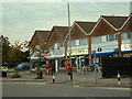
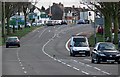
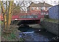
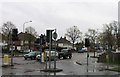
44 photos from this area
Area Information
Key information about the LE2 6FB including its size, population, and administrative classification.
- Area Type
- Postcode
- Area Size
- 1.9 hectares
- Population
- 1617
- Population Density
- 3914 people/km²
House Prices in LE2 6FB
28
Properties
£181,734
Average Sold Price
£64,000
Lowest Price
£450,000
Highest Price
Showing 28 properties
| Address | Type | Beds | Baths | Last Sale Price | Last Sale Date | |
|---|---|---|---|---|---|---|
| 226 Asquith Boulevard, Leicester, LE2 6FB | Semi-detached | 4 | 2 | £300,000 | May 2025 | |
| 228 Asquith Boulevard, Leicester, LE2 6FB | house | - | - | £231,000 | Feb 2025 | |
| 272 Asquith Boulevard, Leicester, LE2 6FB | Detached | 5 | 3 | £450,000 | Oct 2023 | |
| 244 Asquith Boulevard, Leicester, LE2 6FB | house | 3 | - | £245,000 | Feb 2022 | |
| 232 Asquith Boulevard, Leicester, LE2 6FB | house | - | - | £274,000 | Jan 2022 | |
| 276 Asquith Boulevard, Leicester, LE2 6FB | Semi-detached | 2 | - | £165,000 | May 2019 | |
| 246 Asquith Boulevard, Leicester, LE2 6FB | Semi-detached | 2 | 1 | £140,000 | Sep 2017 | |
| 274 Asquith Boulevard, Leicester, LE2 6FB | Detached | 4 | - | £345,000 | Aug 2016 | |
| 234 Asquith Boulevard, Leicester, LE2 6FB | Semi-detached | 3 | - | £155,000 | Mar 2014 | |
| 238 Asquith Boulevard, Leicester, LE2 6FB | Semi-detached | - | - | £120,000 | Jul 2011 |
Page 1 of 3
Energy Efficiency in LE2 6FB
Amenities
Schools
| Rank | School | Type | Entry gender | Ages |
|---|
Explore more schools in this area
Go to Schools tabDemographics
Household Size
Family (3-5 people)
most common
Accommodation Type
Houses
most common
Tenure
80
majority
Ethnic Group
asian_total
most common
Religion
N/A
most common
Household Composition
N/A
most common
Age
47
median
Adults (30-64 years)
most common
Household Deprivation
N/A
with no deprivation
NS-SEC
36
in Lower managerial occupations
Explore more demographic insights in this area
Go to Demographics tabPlanning
Planning Constraints
- Flood RiskPremium
- Ramsar Wetland SitesPremium
- Area of Outstanding Natural BeautyPremium
- Protected Nature ReservePremium
- Protected WoodlandPremium