Area Overview for LE2 6DR
Photos of LE2 6DR
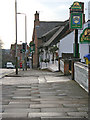

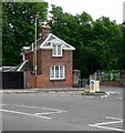
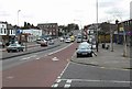

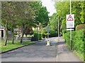
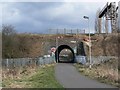
98 photos from this area
Area Information
Key information about the LE2 6DR including its size, population, and administrative classification.
- Area Type
- Postcode
- Area Size
- 1.0 hectares
- Population
- 2323
- Population Density
- 3623 people/km²
House Prices in LE2 6DR
31
Properties
£138,857
Average Sold Price
£34,250
Lowest Price
£220,000
Highest Price
Showing 31 properties
| Address | Type | Beds | Baths | Last Sale Price | Last Sale Date | |
|---|---|---|---|---|---|---|
| 132 Knighton Fields Road East, Leicester, LE2 6DR | Terraced | 2 | 1 | £210,000 | Jun 2025 | |
| 146 Knighton Fields Road East, Leicester, LE2 6DR | Terraced | 2 | 1 | £175,000 | Mar 2025 | |
| 154 Knighton Fields Road East, Leicester, LE2 6DR | Terraced | 2 | 1 | £220,000 | Aug 2024 | |
| 156 Knighton Fields Road East, Leicester, LE2 6DR | Terraced | 2 | 1 | £198,000 | Mar 2023 | |
| 148 Knighton Fields Road East, Leicester, LE2 6DR | Terraced | 2 | 1 | £210,000 | May 2022 | |
| 147 Knighton Fields Road East, Leicester, LE2 6DR | house | 2 | - | £151,000 | Apr 2021 | |
| 143 Knighton Fields Road East, Leicester, LE2 6DR | Terraced | 3 | 1 | £170,000 | Apr 2021 | |
| 124 Knighton Fields Road East, Leicester, LE2 6DR | Terraced | 2 | 1 | £169,500 | Apr 2020 | |
| 145 Knighton Fields Road East, Leicester, LE2 6DR | Terraced | 3 | 1 | £142,000 | Aug 2019 | |
| 136 Knighton Fields Road East, Leicester, LE2 6DR | Terraced | 2 | 1 | £169,950 | Dec 2018 |
Page 1 of 4
Energy Efficiency in LE2 6DR
Amenities
Schools
| Rank | School | Type | Entry gender | Ages |
|---|
Explore more schools in this area
Go to Schools tabDemographics
Household Size
One person
most common
Accommodation Type
Houses
most common
Tenure
45
majority
Ethnic Group
White
most common
Religion
N/A
most common
Household Composition
N/A
most common
Age
22
median
Adults (30-64 years)
most common
Household Deprivation
N/A
with no deprivation
NS-SEC
25
in Lower managerial occupations
Explore more demographic insights in this area
Go to Demographics tabPlanning
Planning Constraints
- Flood RiskPremium
- Ramsar Wetland SitesPremium
- Area of Outstanding Natural BeautyPremium
- Protected Nature ReservePremium
- Protected WoodlandPremium