Area Overview for LE2 5AD
Photos of LE2 5AD
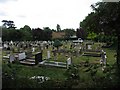
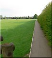
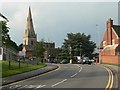
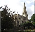
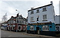
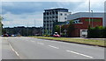
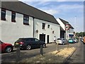
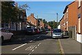
80 photos from this area
Area Information
Key information about the LE2 5AD including its size, population, and administrative classification.
- Area Type
- Postcode
- Area Size
- 8362 m²
- Population
- 1365
- Population Density
- 2907 people/km²
House Prices in LE2 5AD
33
Properties
£136,688
Average Sold Price
£76,000
Lowest Price
£200,000
Highest Price
Showing 33 properties
| Address | Type | Beds | Baths | Last Sale Price | Last Sale Date | |
|---|---|---|---|---|---|---|
| Oadby Carpet Place, 33 Chapel Street, Oadby, LE2 5AD | Semi-detached | 2 | 1 | £195,000 | Aug 2019 | |
| Silkstyle Ltd, 35 Chapel Street, Oadby, LE2 5AD | Detached | 2 | 1 | £200,000 | Feb 2019 | |
| 23 Chapel Street, Oadby, LE2 5AD | Terraced | 2 | 1 | £137,500 | Mar 2016 | |
| 3B Chapel Street, Oadby, LE2 5AD | Flat | 1 | - | £76,000 | Feb 2016 | |
| 25 Chapel Street, Oadby, LE2 5AD | Terraced | 2 | 2 | £125,000 | Nov 2008 | |
| 27 Chapel Street, Oadby, LE2 5AD | Flat | 8 | - | £120,000 | Oct 2008 | |
| 29 Chapel Street, Oadby, LE2 5AD | Terraced | 2 | - | £120,000 | Oct 2008 | |
| 31 Chapel Street, Oadby, LE2 5AD | Land | 2 | - | £120,000 | Oct 2008 | |
| Flat 1, 11 Chapel Street, Oadby, LE2 5AD | Flat | 3 | - | - | - | |
| Flat 2, 11 Chapel Street, Oadby, LE2 5AD | Flat | 3 | - | - | - |
Page 1 of 4
Energy Efficiency in LE2 5AD
Amenities
Schools
| Rank | School | Type | Entry gender | Ages |
|---|
Explore more schools in this area
Go to Schools tabDemographics
Household Size
One person
most common
Accommodation Type
Houses
most common
Tenure
53
majority
Ethnic Group
White
most common
Religion
N/A
most common
Household Composition
N/A
most common
Age
47
median
Adults (30-64 years)
most common
Household Deprivation
N/A
with no deprivation
NS-SEC
27
in Lower managerial occupations
Explore more demographic insights in this area
Go to Demographics tabPlanning
Planning Constraints
- Flood RiskPremium
- Ramsar Wetland SitesPremium
- Area of Outstanding Natural BeautyPremium
- Protected Nature ReservePremium
- Protected WoodlandPremium