Area Overview for LE2 4UY
Photos of LE2 4UY
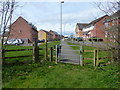
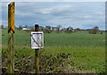
24 photos from this area
Area Information
Key information about the LE2 4UY including its size, population, and administrative classification.
- Area Type
- Postcode
- Area Size
- 2.3 hectares
- Population
- 1969
- Population Density
- 1755 people/km²
House Prices in LE2 4UY
15
Properties
£291,045
Average Sold Price
£112,500
Lowest Price
£450,000
Highest Price
Showing 15 properties
| Address | Type | Beds | Baths | Last Sale Price | Last Sale Date | |
|---|---|---|---|---|---|---|
| 14 Ellis Fields, Oadby, LE2 4UY | Detached | 4 | 1 | £450,000 | May 2024 | |
| 2 Ellis Fields, Oadby, LE2 4UY | house | - | - | £450,000 | Oct 2020 | |
| 8 Ellis Fields, Oadby, LE2 4UY | Detached | 4 | - | £370,000 | Sep 2015 | |
| 3 Ellis Fields, Oadby, LE2 4UY | Detached | 4 | - | £312,000 | Oct 2014 | |
| 6 Ellis Fields, Oadby, LE2 4UY | house | 5 | - | £405,000 | Dec 2011 | |
| 4 Ellis Fields, Oadby, LE2 4UY | house | - | - | £280,000 | Apr 2006 | |
| 5 Ellis Fields, Oadby, LE2 4UY | house | - | - | £249,000 | Jan 2006 | |
| 7 Ellis Fields, Oadby, LE2 4UY | house | 4 | 2 | £250,000 | Mar 2002 | |
| 11 Ellis Fields, Oadby, LE2 4UY | Detached | - | - | £202,000 | Aug 2001 | |
| 10 Ellis Fields, Oadby, LE2 4UY | Detached | - | - | £112,500 | Sep 1998 |
Page 1 of 2
Energy Efficiency in LE2 4UY
Amenities
Schools
| Rank | School | Type | Entry gender | Ages |
|---|
Explore more schools in this area
Go to Schools tabDemographics
Household Size
Family (3-5 people)
most common
Accommodation Type
Houses
most common
Tenure
81
majority
Ethnic Group
asian_total
most common
Religion
N/A
most common
Household Composition
N/A
most common
Age
47
median
Adults (30-64 years)
most common
Household Deprivation
N/A
with no deprivation
NS-SEC
48
in Lower managerial occupations
Explore more demographic insights in this area
Go to Demographics tabPlanning
Planning Constraints
- Flood RiskPremium
- Ramsar Wetland SitesPremium
- Area of Outstanding Natural BeautyPremium
- Protected Nature ReservePremium
- Protected WoodlandPremium