Area Overview for LE2 4NW
Photos of LE2 4NW
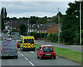

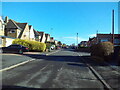
31 photos from this area
Area Information
Key information about the LE2 4NW including its size, population, and administrative classification.
- Area Type
- Postcode
- Area Size
- 1.3 hectares
- Population
- 1713
- Population Density
- 4750 people/km²
House Prices in LE2 4NW
28
Properties
£163,682
Average Sold Price
£57,500
Lowest Price
£300,000
Highest Price
Showing 28 properties
| Address | Type | Beds | Baths | Last Sale Price | Last Sale Date | |
|---|---|---|---|---|---|---|
| 153 Uplands Road, Oadby, LE2 4NW | Flat | - | - | £75,000 | Aug 2023 | |
| 135 Uplands Road, Oadby, LE2 4NW | house | 3 | - | £220,000 | Apr 2023 | |
| 97 Uplands Road, Oadby, LE2 4NW | Detached | 2 | 1 | £268,500 | Sep 2020 | |
| 101 Uplands Road, Oadby, LE2 4NW | Semi-detached | 3 | - | £290,000 | Mar 2020 | |
| 155 Uplands Road, Oadby, LE2 4NW | Flat | - | - | £93,000 | Jan 2020 | |
| 105 Uplands Road, Oadby, LE2 4NW | Semi-detached | 3 | 1 | £290,000 | Jun 2019 | |
| 123 Uplands Road, Oadby, LE2 4NW | Flat | 1 | 1 | £275,000 | May 2018 | |
| 125 Uplands Road, Oadby, LE2 4NW | house | - | - | £300,000 | Dec 2017 | |
| 151 Uplands Road, Oadby, LE2 4NW | Flat | 1 | 1 | £67,500 | Apr 2017 | |
| 113 Uplands Road, Oadby, LE2 4NW | Detached | 3 | 1 | £164,000 | Aug 2013 |
Page 1 of 3
Energy Efficiency in LE2 4NW
Amenities
Schools
| Rank | School | Type | Entry gender | Ages |
|---|
Explore more schools in this area
Go to Schools tabDemographics
Household Size
Family (3-5 people)
most common
Accommodation Type
Houses
most common
Tenure
79
majority
Ethnic Group
asian_total
most common
Religion
N/A
most common
Household Composition
N/A
most common
Age
47
median
Adults (30-64 years)
most common
Household Deprivation
N/A
with no deprivation
NS-SEC
35
in Lower managerial occupations
Explore more demographic insights in this area
Go to Demographics tabPlanning
Planning Constraints
- Flood RiskPremium
- Ramsar Wetland SitesPremium
- Area of Outstanding Natural BeautyPremium
- Protected Nature ReservePremium
- Protected WoodlandPremium