Area Overview for LE2 3YH
Photos of LE2 3YH
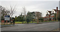
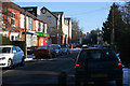
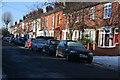
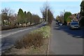
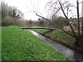
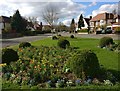
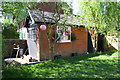
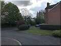
49 photos from this area
Area Information
Key information about the LE2 3YH including its size, population, and administrative classification.
- Area Type
- Postcode
- Area Size
- 1.3 hectares
- Population
- 1569
- Population Density
- 3737 people/km²
House Prices in LE2 3YH
39
Properties
£194,616
Average Sold Price
£59,000
Lowest Price
£355,500
Highest Price
Showing 39 properties
| Address | Type | Beds | Baths | Last Sale Price | Last Sale Date | |
|---|---|---|---|---|---|---|
| 40 Overdale Road, Leicester, LE2 3YH | Semi-detached | 3 | - | £325,000 | Jun 2023 | |
| 34 Overdale Road, Leicester, LE2 3YH | Retail | 3 | 1 | £355,500 | Sep 2022 | |
| 22 Overdale Road, Leicester, LE2 3YH | Semi-detached | 3 | 1 | £277,500 | Nov 2021 | |
| 46 Overdale Road, Leicester, LE2 3YH | Semi-detached | 3 | - | £310,000 | May 2021 | |
| 60 Overdale Road, Leicester, LE2 3YH | Semi-detached | 3 | 1 | £243,000 | Dec 2019 | |
| 2 Overdale Road, Leicester, LE2 3YH | Detached | 4 | - | £283,000 | Aug 2017 | |
| 28 Overdale Road, Leicester, LE2 3YH | Semi-detached | 3 | 1 | £220,000 | Feb 2017 | |
| 76 Overdale Road, Leicester, LE2 3YH | Detached | 3 | - | £269,950 | Jan 2016 | |
| 42 Overdale Road, Leicester, LE2 3YH | Semi-detached | 3 | - | £219,000 | Jan 2016 | |
| 26 Overdale Road, Leicester, LE2 3YH | Semi-detached | 3 | - | £215,000 | Jan 2016 |
Page 1 of 4
Energy Efficiency in LE2 3YH
Amenities
Schools
| Rank | School | Type | Entry gender | Ages |
|---|
Explore more schools in this area
Go to Schools tabDemographics
Household Size
Family (3-5 people)
most common
Accommodation Type
Houses
most common
Tenure
83
majority
Ethnic Group
White
most common
Religion
N/A
most common
Household Composition
N/A
most common
Age
47
median
Adults (30-64 years)
most common
Household Deprivation
N/A
with no deprivation
NS-SEC
43
in Lower managerial occupations
Explore more demographic insights in this area
Go to Demographics tabPlanning
Planning Constraints
- Flood RiskPremium
- Ramsar Wetland SitesPremium
- Area of Outstanding Natural BeautyPremium
- Protected Nature ReservePremium
- Protected WoodlandPremium