Area Overview for LE2 3LS
Photos of LE2 3LS

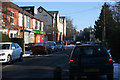
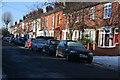
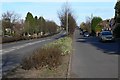
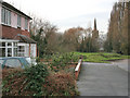
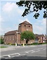
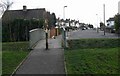
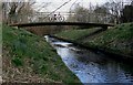
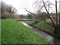
49 photos from this area
Area Information
Key information about the LE2 3LS including its size, population, and administrative classification.
- Area Type
- Postcode
- Area Size
- 9654 m²
- Population
- 1451
- Population Density
- 4505 people/km²
House Prices in LE2 3LS
30
Properties
£275,039
Average Sold Price
£131,000
Lowest Price
£575,000
Highest Price
Showing 30 properties
| Address | Type | Beds | Baths | Last Sale Price | Last Sale Date | |
|---|---|---|---|---|---|---|
| 47 South Knighton Road, Leicester, LE2 3LS | Semi-detached | 3 | 1 | £436,000 | Aug 2024 | |
| 69 South Knighton Road, Leicester, LE2 3LS | Terraced | 4 | 1 | £453,900 | Jun 2024 | |
| 51 South Knighton Road, Leicester, LE2 3LS | house | - | - | £375,000 | Nov 2023 | |
| 63 South Knighton Road, Leicester, LE2 3LS | Semi-detached | 3 | 2 | £575,000 | Oct 2023 | |
| 27 South Knighton Road, Leicester, LE2 3LS | Semi-detached | 4 | 2 | £395,000 | Aug 2022 | |
| 25 South Knighton Road, Leicester, LE2 3LS | Semi-detached | 4 | 2 | £332,000 | Sep 2021 | |
| 23 South Knighton Road, Leicester, LE2 3LS | Semi-detached | 3 | 2 | £295,000 | Feb 2021 | |
| 81 South Knighton Road, Leicester, LE2 3LS | Semi-detached | 3 | 2 | £215,000 | Feb 2018 | |
| 41 South Knighton Road, Leicester, LE2 3LS | Terraced | 3 | 2 | £260,000 | Dec 2016 | |
| 79 South Knighton Road, Leicester, LE2 3LS | Semi-detached | 2 | 1 | £195,000 | Jun 2014 |
Page 1 of 3
Energy Efficiency in LE2 3LS
Amenities
Schools
| Rank | School | Type | Entry gender | Ages |
|---|
Explore more schools in this area
Go to Schools tabDemographics
Household Size
Two person
most common
Accommodation Type
Houses
most common
Tenure
72
majority
Ethnic Group
White
most common
Religion
N/A
most common
Household Composition
N/A
most common
Age
47
median
Adults (30-64 years)
most common
Household Deprivation
N/A
with no deprivation
NS-SEC
54
in Lower managerial occupations
Explore more demographic insights in this area
Go to Demographics tabPlanning
Planning Constraints
- Flood RiskPremium
- Ramsar Wetland SitesPremium
- Area of Outstanding Natural BeautyPremium
- Protected Nature ReservePremium
- Protected WoodlandPremium