Area Overview for LE2 3JD
Photos of LE2 3JD
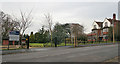
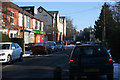
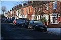
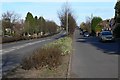
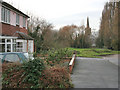
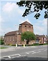
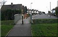
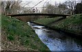
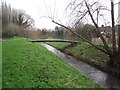
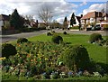
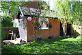
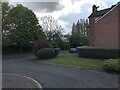
49 photos from this area
Area Information
Key information about the LE2 3JD including its size, population, and administrative classification.
- Area Type
- Postcode
- Area Size
- 4.0 hectares
- Population
- 1451
- Population Density
- 4505 people/km²
House Prices in LE2 3JD
27
Properties
£589,593
Average Sold Price
£150,000
Lowest Price
£1,035,000
Highest Price
Showing 27 properties
| Address | Type | Beds | Baths | Last Sale Price | Last Sale Date | |
|---|---|---|---|---|---|---|
| 41 Elms Road, Leicester, LE2 3JD | house | 5 | 2 | £825,000 | Dec 2025 | |
| 33A Elms Road, Leicester, LE2 3JD | Detached | 4 | 5 | £720,000 | Jan 2025 | |
| Lester Hall Apartments, 15 Elms Road, Leicester, LE2 3JD | hospital_care_home | - | - | £950,000 | Feb 2021 | |
| 37 Elms Road, Leicester, LE2 3JD | house | - | - | £575,000 | Dec 2020 | |
| 21 Elms Road, Leicester, LE2 3JD | Detached | 5 | 1 | £900,000 | Oct 2020 | |
| 59 Elms Road, Leicester, LE2 3JD | house | - | - | £445,000 | Apr 2019 | |
| Harley Grange, 25 Elms Road, Leicester, LE2 3JD | hospital_care_home | - | - | £1,035,000 | Apr 2019 | |
| 27A Elms Road, Leicester, LE2 3JD | Bungalow | 5 | 3 | £625,000 | Nov 2015 | |
| 45 Elms Road, Leicester, LE2 3JD | Detached | 5 | - | £590,000 | Oct 2014 | |
| 35 Elms Road, Leicester, LE2 3JD | house | - | - | £608,084 | Sep 2012 |
Page 1 of 3
Energy Efficiency in LE2 3JD
Amenities
Schools
| Rank | School | Type | Entry gender | Ages |
|---|
Explore more schools in this area
Go to Schools tabDemographics
Household Size
Two person
most common
Accommodation Type
Houses
most common
Tenure
72
majority
Ethnic Group
White
most common
Religion
N/A
most common
Household Composition
N/A
most common
Age
47
median
Adults (30-64 years)
most common
Household Deprivation
N/A
with no deprivation
NS-SEC
54
in Lower managerial occupations
Explore more demographic insights in this area
Go to Demographics tabPlanning
Planning Constraints
- Flood RiskPremium
- Ramsar Wetland SitesPremium
- Area of Outstanding Natural BeautyPremium
- Protected Nature ReservePremium
- Protected WoodlandPremium