Area Overview for LE2 3BF
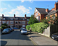
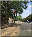
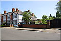
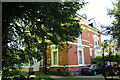
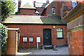
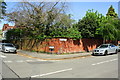
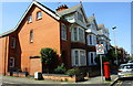
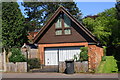
Photos of LE2 3BF
Area Information
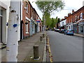
Living in LE2 3BF means being part of a small, tightly knit residential cluster in England, home to around 1,710 people. This area is characterised by its compact size and a population skewed heavily towards young adults, with the median age at 22. Daily life here is shaped by proximity to essential services and transport links, making it practical for those who value convenience. The area’s housing stock is dominated by individual homes, reflecting a community where owner-occupation is less common than rental living. While the population is small, the presence of multiple primary schools and accessible rail networks suggests a balance between residential tranquillity and urban connectivity. Residents benefit from a broadband score of 100, ensuring seamless internet access, though mobile coverage is slightly lower at 85. The area’s low flood risk and absence of environmental constraints like protected woodlands or wetlands further contribute to its appeal as a stable, low-hazard location. For those seeking a compact, functional living space with nearby amenities, LE2 3BF offers a straightforward, no-frills environment.
- Area Type
- Postcode
- Area Size
- Not available
- Population
- 1710
- Population Density
- 7526 people/km²
The property market in LE2 3BF reflects a small, residential cluster where 42% of homes are owner-occupied, with the remaining 58% likely to be rented. The accommodation type is predominantly houses, which is notable in a small postcode area, suggesting a mix of family homes and individual properties. This composition implies limited housing stock, potentially making the area competitive for buyers seeking larger, standalone homes. However, the small population and compact size mean that properties are likely to be spaced apart, reducing density but offering more private outdoor space. For buyers, this could mean a focus on individual homes rather than flats or shared accommodations. The rental market’s dominance also indicates that the area may attract tenants, particularly young professionals or students, which could influence property values and availability.
House Prices in LE2 3BF
No properties found in this postcode.
Energy Efficiency in LE2 3BF
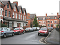
The lifestyle in LE2 3BF is shaped by its proximity to essential amenities. Residents can access five retail outlets, including Sainsburys Clarendon and Co-op Clarendon, ensuring convenience for shopping and daily essentials. The area’s rail network, with stations at Leicester, South Wigston, and Syston, connects to broader transport routes, while Leicester Airport is a short distance away for regional travel. The presence of two metro stations, Leicester North and Great Central Railway, adds to the area’s connectivity. Though the data does not specify parks or leisure facilities, the absence of environmental constraints like protected woodlands or AONB designations suggests open spaces may be available. The combination of retail, rail, and air travel options makes daily life functional, though the area’s small size means it relies on nearby hubs for more extensive leisure or cultural offerings.
Amenities
Schools
Residents of LE2 3BF have access to several primary schools, including Avenue Infant and Nursery School, Avenue Junior School, St John the Baptist CofE Primary School, and Avenue Primary School. Three of these schools—St John the Baptist CofE Primary and Avenue Primary—have been rated “good” by Ofsted, offering families a reliable choice for early education. The concentration of primary schools within the area suggests a strong focus on local schooling, reducing the need for long commutes. For families with young children, this proximity to multiple schools is a key advantage, though the absence of secondary schools means older students may need to travel further. The mix of school types, including both state and church-affiliated institutions, provides diversity in educational options.
| Rank | School | Type | Entry gender | Ages |
|---|
Explore more schools in this area
Go to Schools tabDemographics
The community in LE2 3BF is predominantly young, with the median age at 22 and the most common age range being 15–29 years. This demographic skew suggests a population focused on early career development or education. Home ownership accounts for 42% of households, with the remaining 58% likely to be renters, indicating a rental market that may cater to students or transient workers. The accommodation type is primarily houses, which is unusual for areas with high rental rates, hinting at a mix of owner-occupied properties and larger family homes. The predominant ethnic group is White, though no specific data on diversity or deprivation is provided. The youth-driven population profile means the area is likely to have a dynamic, evolving character, shaped by the needs of young adults rather than long-term family communities.
Household Size
Accommodation Type
Tenure
Ethnic Group
Religion
Household Composition
Age
Household Deprivation
NS-SEC
Explore more demographic insights in this area
Go to Demographics tabPlanning
Planning Constraints
- Flood RiskPremium
- Ramsar Wetland SitesPremium
- Area of Outstanding Natural BeautyPremium
- Protected Nature ReservePremium
- Protected WoodlandPremium