Area Overview for LE2 2PU
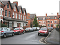
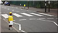
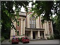
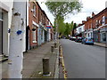
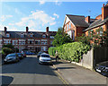
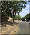
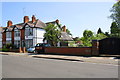
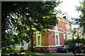
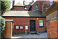
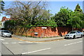
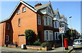
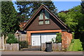
Photos of LE2 2PU
Area Information
Living in LE2 2PU means being part of a tightly packed residential cluster in Leicester, England. The area covers just 1,957 square metres, yet it accommodates 1,636 residents, resulting in a population density of 836,187 people per square kilometre. This compactness creates a sense of proximity to local amenities, though it also reflects the area’s focus on high-density living. The community is predominantly composed of adults aged 30–64, with a median age of 47, suggesting a mature, stable population. Daily life here is shaped by the availability of nearby schools, transport links, and retail options, making it practical for families and professionals. The area’s small size means that most essential services are within walking or short driving distance, though its limited footprint also means it is not a sprawling suburb. For those seeking a mix of convenience and connectivity, LE2 2PU offers a compact, functional living environment with a clear emphasis on accessibility over space.
- Area Type
- Postcode
- Area Size
- 1957 m²
- Population
- 1636
- Population Density
- 5002 people/km²
The property market in LE2 2PU is characterised by a high proportion of flats, reflecting the area’s compact nature and high population density. With 44% of residents owning their homes, the market is not dominated by owner-occupation but instead includes a significant rental component. This suggests that while some properties are long-term investments, others are likely rented out to tenants, particularly in multi-unit buildings. The prevalence of flats may appeal to buyers seeking manageable, centrally located homes, though the area’s small size means there is limited scope for expansion or redevelopment. For prospective buyers, this small postcode area offers a focused selection of properties, all within proximity to essential services. However, the high density and flat-dominated stock may also mean that the market is more competitive, with fewer unique opportunities compared to larger, more varied neighbourhoods.
House Prices in LE2 2PU
Showing 1 properties
| Address | Type | Beds | Baths | Last Sale Price | Last Sale Date | |
|---|---|---|---|---|---|---|
| 362 London Road, Leicester, LE2 2PU | hospital_care_home | - | - | - | - |
Energy Efficiency in LE2 2PU
Daily life in LE2 2PU is shaped by its proximity to essential amenities. The area’s retail sector includes five shops, such as Co-op Leicester and Sainsburys Clarendon, offering convenience for grocery shopping and other needs. For transport, residents have access to three railway stations and two metro stops, ensuring easy movement to nearby towns and cities. The presence of Leicester Airport provides additional travel options. While the data does not mention parks or leisure facilities, the area’s compact nature suggests that nearby green spaces or community hubs may be accessible within a short journey. The mix of retail, transport, and proximity to schools creates a functional lifestyle, though the high population density may mean a more urban, less spacious environment. Overall, LE2 2PU offers a practical, service-rich living experience for those prioritising accessibility over expansive living space.
Amenities
Schools
The schools near LE2 2PU include a mix of independent and special education institutions. Leicester Islamic Academy is an independent school with a good Ofsted rating, offering a structured educational environment. Woodbank Grammar School is also independent, catering to families seeking private education. South Lodge School is a special school, providing tailored support for students with specific needs. Highfields Boys’ Secondary School is another independent option, adding to the area’s range of educational choices. This combination of school types means families have options between private education and specialist support, though no state schools are listed in the data. The presence of multiple independent schools may indicate a demand for non-state education, while the special school highlights the area’s capacity to serve diverse needs. However, the absence of state schools could be a consideration for those prioritising public education.
| Rank | School | Type | Entry gender | Ages |
|---|
Explore more schools in this area
Go to Schools tabDemographics
The demographics of LE2 2PU reflect a mature, predominantly White population, with 44% of residents owning their homes. The majority of the 1,636 residents fall within the 30–64 age range, indicating a community centred on middle-aged adults and families. This age profile suggests a stable, established neighbourhood with fewer young children or retirees compared to other areas. The high home ownership rate of 44% is notable, though it also implies that 56% of residents rent, pointing to a mix of owner-occupied and rental properties. The area’s accommodation is primarily flats, which aligns with its high population density. While the data does not specify deprivation levels, the combination of older residents and high-density housing may influence the area’s social dynamics and service needs. The predominant ethnic group being White further shapes the cultural and social landscape, though the absence of detailed diversity metrics means the full picture remains opaque.
Household Size
Accommodation Type
Tenure
Ethnic Group
Religion
Household Composition
Age
Household Deprivation
NS-SEC
Explore more demographic insights in this area
Go to Demographics tabPlanning
Planning Constraints
- Flood RiskPremium
- Ramsar Wetland SitesPremium
- Area of Outstanding Natural BeautyPremium
- Protected Nature ReservePremium
- Protected WoodlandPremium