Area Overview for LE2 2AR
Photos of LE2 2AR
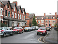
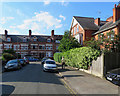
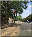
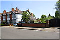
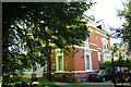
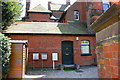
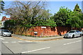
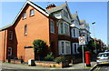
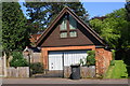
61 photos from this area
Area Information
Key information about the LE2 2AR including its size, population, and administrative classification.
- Area Type
- Postcode
- Area Size
- 1.0 hectares
- Population
- 1409
- Population Density
- 6396 people/km²
House Prices in LE2 2AR
29
Properties
£239,214
Average Sold Price
£75,000
Lowest Price
£500,000
Highest Price
Showing 29 properties
| Address | Type | Beds | Baths | Last Sale Price | Last Sale Date | |
|---|---|---|---|---|---|---|
| 51 Waldale Drive, Leicester, LE2 2AR | Terraced | 3 | 1 | £270,000 | Dec 2025 | |
| 38 Waldale Drive, Leicester, LE2 2AR | Detached | 3 | 2 | £400,000 | Jul 2025 | |
| 47 Waldale Drive, Leicester, LE2 2AR | house | - | - | £280,000 | Jun 2024 | |
| 30 Waldale Drive, Leicester, LE2 2AR | Detached | 3 | 3 | £500,000 | Jan 2022 | |
| 20 Waldale Drive, Leicester, LE2 2AR | house | - | - | £340,100 | Nov 2021 | |
| 24 Waldale Drive, Leicester, LE2 2AR | Detached | 3 | 2 | £280,250 | Sep 2021 | |
| 35 Waldale Drive, Leicester, LE2 2AR | Terraced | 4 | 2 | £270,000 | Feb 2021 | |
| 57 Waldale Drive, Leicester, LE2 2AR | house | - | - | £300,000 | Feb 2021 | |
| 39 Waldale Drive, Leicester, LE2 2AR | Semi-detached | 4 | 2 | £297,500 | Mar 2020 | |
| 32 Waldale Drive, Leicester, LE2 2AR | Detached | 3 | 2 | £283,000 | Jul 2019 |
Page 1 of 3
Energy Efficiency in LE2 2AR
Amenities
Schools
| Rank | School | Type | Entry gender | Ages |
|---|
Explore more schools in this area
Go to Schools tabDemographics
Household Size
One person
most common
Accommodation Type
Flats
most common
Tenure
51
majority
Ethnic Group
White
most common
Religion
N/A
most common
Household Composition
N/A
most common
Age
47
median
Adults (30-64 years)
most common
Household Deprivation
N/A
with no deprivation
NS-SEC
43
in Lower managerial occupations
Explore more demographic insights in this area
Go to Demographics tabPlanning
Planning Constraints
- Flood RiskPremium
- Ramsar Wetland SitesPremium
- Area of Outstanding Natural BeautyPremium
- Protected Nature ReservePremium
- Protected WoodlandPremium