Area Overview for LE2 0DT
Photos of LE2 0DT
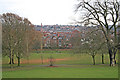
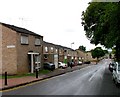
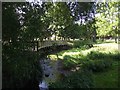
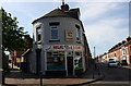
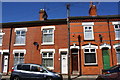
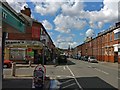
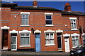
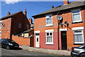
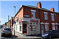
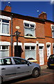
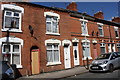
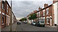
96 photos from this area
Area Information
Key information about the LE2 0DT including its size, population, and administrative classification.
- Area Type
- Postcode
- Area Size
- 7492 m²
- Population
- 1819
- Population Density
- 26173 people/km²
House Prices in LE2 0DT
31
Properties
£111,875
Average Sold Price
£42,000
Lowest Price
£198,000
Highest Price
Showing 31 properties
| Address | Type | Beds | Baths | Last Sale Price | Last Sale Date | |
|---|---|---|---|---|---|---|
| 178 Melbourne Road, Leicester, LE2 0DT | house | - | - | £198,000 | Aug 2015 | |
| 188 Melbourne Road, Leicester, LE2 0DT | house | - | - | £160,000 | Feb 2011 | |
| 172 Melbourne Road, Leicester, LE2 0DT | house | - | - | £42,000 | Nov 1996 | |
| Part Ground And First Floor Flat, 200 Melbourne Road, Leicester, LE2 0DT | Flat | - | - | £47,500 | Jul 1995 | |
| 174 Melbourne Road, Leicester, LE2 0DT | Terraced | 5 | 3 | - | - | |
| 196A Melbourne Road, Leicester, LE2 0DT | Terraced | 5 | 2 | - | - | |
| 180 Melbourne Road, Leicester, LE2 0DT | Terraced | 5 | 2 | - | - | |
| 176 Melbourne Road, Leicester, LE2 0DT | house | - | - | - | - | |
| 162 Melbourne Road, Leicester, LE2 0DT | Terraced | - | - | - | - | |
| 158 Melbourne Road, Leicester, LE2 0DT | Terraced | - | - | - | - |
Page 1 of 4
Energy Efficiency in LE2 0DT
Amenities
Schools
| Rank | School | Type | Entry gender | Ages |
|---|
Explore more schools in this area
Go to Schools tabDemographics
Household Size
Family (3-5 people)
most common
Accommodation Type
Houses
most common
Tenure
49
majority
Ethnic Group
asian_total
most common
Religion
N/A
most common
Household Composition
N/A
most common
Age
47
median
Adults (30-64 years)
most common
Household Deprivation
N/A
with no deprivation
NS-SEC
12
in Lower managerial occupations
Explore more demographic insights in this area
Go to Demographics tabPlanning
Planning Constraints
- Flood RiskPremium
- Ramsar Wetland SitesPremium
- Area of Outstanding Natural BeautyPremium
- Protected Nature ReservePremium
- Protected WoodlandPremium