Area Overview for LE19 4DE
Photos of LE19 4DE
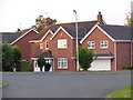
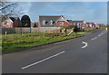
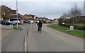
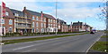
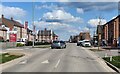
38 photos from this area
Area Information
Key information about the LE19 4DE including its size, population, and administrative classification.
- Area Type
- Postcode
- Area Size
- 9179 m²
- Population
- 2542
- Population Density
- 298 people/km²
House Prices in LE19 4DE
25
Properties
£285,603
Average Sold Price
£146,200
Lowest Price
£437,995
Highest Price
Showing 25 properties
| Address | Type | Beds | Baths | Last Sale Price | Last Sale Date | |
|---|---|---|---|---|---|---|
| 10 Laxford Lane, Lubbesthorpe, LE19 4DE | Semi-detached | 2 | 1 | £240,000 | Feb 2025 | |
| 24 Laxford Lane, Lubbesthorpe, LE19 4DE | house | - | - | £437,995 | Apr 2024 | |
| 28 Laxford Lane, Lubbesthorpe, LE19 4DE | house | - | - | £418,996 | Apr 2024 | |
| 3 Laxford Lane, Lubbesthorpe, LE19 4DE | Bungalow | 2 | 1 | £262,900 | Feb 2024 | |
| 22 Laxford Lane, Lubbesthorpe, LE19 4DE | house | - | - | £339,995 | Jan 2024 | |
| 7 Laxford Lane, Lubbesthorpe, LE19 4DE | Bungalow | - | - | £242,995 | Dec 2022 | |
| 11 Laxford Lane, Lubbesthorpe, LE19 4DE | Semi-detached | 2 | 1 | £229,995 | Sep 2022 | |
| 9 Laxford Lane, Lubbesthorpe, LE19 4DE | house | - | - | £259,995 | Sep 2022 | |
| 5 Laxford Lane, Lubbesthorpe, LE19 4DE | Semi-detached | 2 | 1 | £239,995 | Jul 2022 | |
| 1 Laxford Lane, Lubbesthorpe, LE19 4DE | house | - | - | £339,995 | Jun 2022 |
Page 1 of 3
Energy Efficiency in LE19 4DE
Amenities
Schools
| Rank | School | Type | Entry gender | Ages |
|---|
Explore more schools in this area
Go to Schools tabDemographics
Household Size
Family (3-5 people)
most common
Accommodation Type
Houses
most common
Tenure
77
majority
Ethnic Group
White
most common
Religion
N/A
most common
Household Composition
N/A
most common
Age
47
median
Adults (30-64 years)
most common
Household Deprivation
N/A
with no deprivation
NS-SEC
44
in Lower managerial occupations
Explore more demographic insights in this area
Go to Demographics tabPlanning
Planning Constraints
- Flood RiskPremium
- Ramsar Wetland SitesPremium
- Area of Outstanding Natural BeautyPremium
- Protected Nature ReservePremium
- Protected WoodlandPremium