Area Overview for LE19 4AQ
Photos of LE19 4AQ
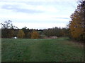
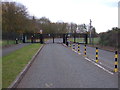
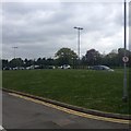
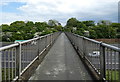
29 photos from this area
Area Information
Key information about the LE19 4AQ including its size, population, and administrative classification.
- Area Type
- Postcode
- Area Size
- 45.7 hectares
- Population
- 2428
- Population Density
- 772 people/km²
House Prices in LE19 4AQ
27
Properties
£178,194
Average Sold Price
£25,000
Lowest Price
£340,000
Highest Price
Showing 27 properties
| Address | Type | Beds | Baths | Last Sale Price | Last Sale Date | |
|---|---|---|---|---|---|---|
| 81 Blaby Road, Enderby, LE19 4AQ | Semi-detached | 3 | 1 | £260,000 | Dec 2025 | |
| 75 Blaby Road, Enderby, LE19 4AQ | Detached | 3 | - | £340,000 | Aug 2024 | |
| 79 Blaby Road, Enderby, LE19 4AQ | Semi-detached | 3 | - | £235,500 | Dec 2021 | |
| 107 Blaby Road, Enderby, LE19 4AQ | house | 3 | 1 | £190,000 | Nov 2020 | |
| 63 Blaby Road, Enderby, LE19 4AQ | Detached | 4 | - | £285,000 | Mar 2018 | |
| 71 Blaby Road, Enderby, LE19 4AQ | Detached | 3 | 1 | £230,000 | Aug 2016 | |
| 101 Blaby Road, Enderby, LE19 4AQ | Semi-detached | 3 | 1 | £189,950 | Apr 2016 | |
| 61 Blaby Road, Enderby, LE19 4AQ | Detached | 5 | - | £217,000 | Nov 2013 | |
| 99 Blaby Road, Enderby, LE19 4AQ | Semi-detached | 3 | - | £149,950 | Oct 2013 | |
| 91 Blaby Road, Enderby, LE19 4AQ | house | - | - | £148,000 | Apr 2009 |
Page 1 of 3
Energy Efficiency in LE19 4AQ
Amenities
Schools
| Rank | School | Type | Entry gender | Ages |
|---|
Explore more schools in this area
Go to Schools tabDemographics
Household Size
Family (3-5 people)
most common
Accommodation Type
Houses
most common
Tenure
73
majority
Ethnic Group
White
most common
Religion
N/A
most common
Household Composition
N/A
most common
Age
47
median
Adults (30-64 years)
most common
Household Deprivation
N/A
with no deprivation
NS-SEC
31
in Lower managerial occupations
Explore more demographic insights in this area
Go to Demographics tabPlanning
Planning Constraints
- Flood RiskPremium
- Ramsar Wetland SitesPremium
- Area of Outstanding Natural BeautyPremium
- Protected Nature ReservePremium
- Protected WoodlandPremium