Area Overview for LE19 3YU
Photos of LE19 3YU

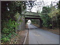
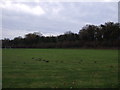
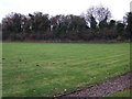
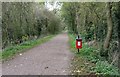
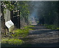
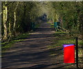
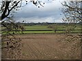
25 photos from this area
Area Information
Key information about the LE19 3YU including its size, population, and administrative classification.
- Area Type
- Postcode
- Area Size
- 4.6 hectares
- Population
- 1440
- Population Density
- 969 people/km²
House Prices in LE19 3YU
16
Properties
£230,419
Average Sold Price
£82,500
Lowest Price
£345,000
Highest Price
Showing 16 properties
| Address | Type | Beds | Baths | Last Sale Price | Last Sale Date | |
|---|---|---|---|---|---|---|
| 18 Grizedale Grove, Narborough, LE19 3YU | Detached | 4 | 2 | £343,000 | May 2024 | |
| 7 Grizedale Grove, Narborough, LE19 3YU | house | - | - | £345,000 | Jun 2021 | |
| 1 Grizedale Grove, Narborough, LE19 3YU | Detached | 4 | 3 | £320,000 | May 2021 | |
| 16 Grizedale Grove, Narborough, LE19 3YU | house | - | - | £322,000 | Nov 2020 | |
| 13 Grizedale Grove, Narborough, LE19 3YU | house | - | - | £245,000 | Jun 2020 | |
| 3 Grizedale Grove, Narborough, LE19 3YU | house | 3 | - | £194,000 | Jun 2012 | |
| 10 Grizedale Grove, Narborough, LE19 3YU | house | - | - | £200,000 | Jul 2009 | |
| 14 Grizedale Grove, Narborough, LE19 3YU | house | - | - | £225,000 | May 2009 | |
| 20 Grizedale Grove, Narborough, LE19 3YU | Detached | - | - | £248,000 | Jul 2007 | |
| 15 Grizedale Grove, Narborough, LE19 3YU | Detached | - | - | £245,950 | Dec 2005 |
Page 1 of 2
Energy Efficiency in LE19 3YU
Amenities
Schools
| Rank | School | Type | Entry gender | Ages |
|---|
Explore more schools in this area
Go to Schools tabDemographics
Household Size
Family (3-5 people)
most common
Accommodation Type
Houses
most common
Tenure
88
majority
Ethnic Group
White
most common
Religion
N/A
most common
Household Composition
N/A
most common
Age
47
median
Adults (30-64 years)
most common
Household Deprivation
N/A
with no deprivation
NS-SEC
43
in Lower managerial occupations
Explore more demographic insights in this area
Go to Demographics tabPlanning
Planning Constraints
- Flood RiskPremium
- Ramsar Wetland SitesPremium
- Area of Outstanding Natural BeautyPremium
- Protected Nature ReservePremium
- Protected WoodlandPremium