Area Overview for LE19 2GB
Photos of LE19 2GB
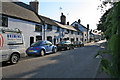

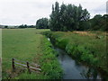
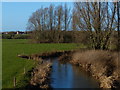
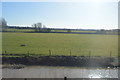
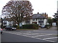
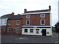
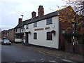
29 photos from this area
Area Information
Key information about the LE19 2GB including its size, population, and administrative classification.
- Area Type
- Postcode
- Area Size
- 2.6 hectares
- Population
- 1845
- Population Density
- 1710 people/km²
House Prices in LE19 2GB
30
Properties
£250,153
Average Sold Price
£46,000
Lowest Price
£870,000
Highest Price
Showing 30 properties
| Address | Type | Beds | Baths | Last Sale Price | Last Sale Date | |
|---|---|---|---|---|---|---|
| 96 Coventry Road, Narborough Town, Narborough, LE19 2GB | Detached | 4 | 2 | £650,000 | Feb 2024 | |
| Tall Trees, Coventry Road, Narborough, LE19 2GB | house | 3 | - | £870,000 | Mar 2021 | |
| 25 Coventry Road, Narborough, LE19 2GB | Semi-detached | 3 | - | £269,950 | Nov 2020 | |
| 46 Coventry Road, Narborough, LE19 2GB | Terraced | 3 | - | £245,000 | Dec 2018 | |
| 60 Coventry Road, Narborough, LE19 2GB | house | - | - | £220,000 | Oct 2016 | |
| 72 Coventry Road, Narborough, LE19 2GB | Bungalow | 3 | - | £260,000 | Feb 2016 | |
| 23 Coventry Road, Narborough, LE19 2GB | Semi-detached | 3 | - | £190,000 | Jul 2015 | |
| 44 Coventry Road, Narborough, LE19 2GB | house | - | - | £206,000 | Mar 2013 | |
| 21 Coventry Road, Narborough, LE19 2GB | Detached | 4 | 2 | £195,000 | Oct 2012 | |
| 56 Coventry Road, Narborough, LE19 2GB | house | - | - | £194,000 | Jun 2011 |
Page 1 of 3
Energy Efficiency in LE19 2GB
Amenities
Schools
| Rank | School | Type | Entry gender | Ages |
|---|
Explore more schools in this area
Go to Schools tabDemographics
Household Size
One person
most common
Accommodation Type
Houses
most common
Tenure
72
majority
Ethnic Group
White
most common
Religion
N/A
most common
Household Composition
N/A
most common
Age
47
median
Adults (30-64 years)
most common
Household Deprivation
N/A
with no deprivation
NS-SEC
40
in Lower managerial occupations
Explore more demographic insights in this area
Go to Demographics tabPlanning
Planning Constraints
- Flood RiskPremium
- Ramsar Wetland SitesPremium
- Area of Outstanding Natural BeautyPremium
- Protected Nature ReservePremium
- Protected WoodlandPremium