Area Overview for LE19 2ED
Photos of LE19 2ED
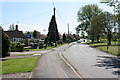
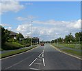
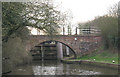

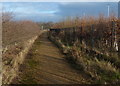
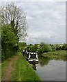
74 photos from this area
Area Information
Key information about the LE19 2ED including its size, population, and administrative classification.
- Area Type
- Postcode
- Area Size
- 3.8 hectares
- Population
- 2428
- Population Density
- 772 people/km²
House Prices in LE19 2ED
19
Properties
£249,366
Average Sold Price
£113,000
Lowest Price
£478,000
Highest Price
Showing 19 properties
| Address | Type | Beds | Baths | Last Sale Price | Last Sale Date | |
|---|---|---|---|---|---|---|
| 21 Old Church Road, Enderby, LE19 2ED | Terraced | 2 | 1 | £113,000 | Dec 2024 | |
| 33 Old Church Road, Enderby, LE19 2ED | Detached | 4 | 2 | £478,000 | Nov 2023 | |
| 31 Old Church Road, Enderby, LE19 2ED | Detached | 3 | 1 | £335,000 | Jun 2023 | |
| 15 Old Church Road, Enderby, LE19 2ED | house | 3 | 2 | £240,000 | Mar 2023 | |
| 37 Old Church Road, Enderby, LE19 2ED | house | - | - | £212,500 | Jul 2020 | |
| 17 Old Church Road, Enderby, LE19 2ED | Semi-detached | 3 | 2 | £212,000 | Dec 2019 | |
| 35 Old Church Road, Enderby, LE19 2ED | house | - | - | £235,000 | Sep 2017 | |
| 39 Old Church Road, Enderby, LE19 2ED | Semi-detached | 4 | - | £210,000 | Jul 2016 | |
| 3 Old Church Road, Enderby, LE19 2ED | Detached | 4 | - | £267,500 | Oct 2015 | |
| 1 Old Church Road, Enderby, LE19 2ED | house | - | - | £215,000 | Jun 2013 |
Page 1 of 2
Energy Efficiency in LE19 2ED
Amenities
Schools
| Rank | School | Type | Entry gender | Ages |
|---|
Explore more schools in this area
Go to Schools tabDemographics
Household Size
Family (3-5 people)
most common
Accommodation Type
Houses
most common
Tenure
73
majority
Ethnic Group
White
most common
Religion
N/A
most common
Household Composition
N/A
most common
Age
47
median
Adults (30-64 years)
most common
Household Deprivation
N/A
with no deprivation
NS-SEC
31
in Lower managerial occupations
Explore more demographic insights in this area
Go to Demographics tabPlanning
Planning Constraints
- Flood RiskPremium
- Ramsar Wetland SitesPremium
- Area of Outstanding Natural BeautyPremium
- Protected Nature ReservePremium
- Protected WoodlandPremium