Area Overview for LE19 1ST
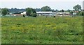
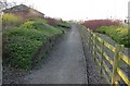
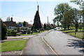
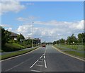
Photos of LE19 1ST


Area Information
Living in LE19 1ST means inhabiting a compact, residential postcode area in England, covering 3.5 hectares and home to 2,428 residents. This small cluster is defined by its density, with 772 people per square kilometre, creating a tightly knit community. The area’s character is shaped by its demographic profile: predominantly adults aged 30–64, with a median age of 47. Most residents own their homes, and the housing stock is largely composed of houses rather than flats. Daily life here is grounded in proximity to essential services, with retail outlets, rail links, and educational institutions within practical reach. While the area is not expansive, its compact nature fosters a sense of familiarity, though it also means residents must consider nearby regions for broader amenities. The low flood risk and absence of environmental constraints suggest a stable living environment, though the high crime risk necessitates vigilance. For those seeking a balanced blend of residential comfort and accessibility, LE19 1ST offers a focused snapshot of suburban living.
- Area Type
- Postcode
- Area Size
- 3.5 hectares
- Population
- 2428
- Population Density
- 772 people/km²
The property market in LE19 1ST is characterised by a high rate of home ownership (73%) and a predominance of houses over flats. This suggests a residential area where long-term occupancy is the norm, with limited rental activity. The compact size of the area—just 3.5 hectares—means the housing stock is finite, which could influence property availability and prices. Buyers should consider the surrounding regions for a broader selection, as the immediate vicinity may have limited scope for expansion. The presence of houses rather than flats indicates a preference for traditional, standalone homes, which may appeal to families or those seeking more space. However, the small area size also means competition for properties could be keen, particularly for those prioritising proximity to local amenities. For buyers, this underscores the need to evaluate both the area’s immediate offerings and its connectivity to nearby regions.
House Prices in LE19 1ST
Showing 2 properties
| Address | Type | Beds | Baths | Last Sale Price | Last Sale Date | |
|---|---|---|---|---|---|---|
| Applied Optical Technologies Ltd, Pt Ground Floor, 2 Penman Way, Enderby, LE19 1ST | Office | - | - | - | - | |
| Sytner Ltd, Pt Grd Floor And 1ST Flr, 2 Penman Way, Enderby, LE19 1ST | office_workshop | - | - | - | - |
Energy Efficiency in LE19 1ST
The lifestyle in LE19 1ST is shaped by its proximity to retail, dining, and transport hubs. Nearby retail options include Sainsburys Fosse, M&S Fosse, and Asda Leicester, offering a range of shopping experiences within easy reach. These venues cater to daily needs, from groceries to clothing, supporting a convenient, self-contained lifestyle. The area’s rail and metro links, such as Leicester North and Great Central Railway, provide access to broader leisure and employment opportunities beyond the immediate postcode. While the data does not specify parks or recreational spaces, the presence of multiple retail and transport points suggests a focus on practicality over expansive green spaces. For residents, this means a balance of accessibility and functionality, with amenities designed to meet everyday requirements without requiring long commutes.
Amenities
Schools
Residents of LE19 1ST have access to Brockington College, a primary school, and a secondary academy with a satisfactory Ofsted rating. The presence of both a primary school and an academy provides families with options tailored to different educational stages and approaches. Brockington College’s dual role as a primary and academy suggests a focus on continuous education within the area, though its Ofsted rating indicates room for improvement in certain aspects of performance. For families prioritising school quality, the academy’s satisfactory rating may be a factor in decision-making, though further details on specific subjects or facilities are not provided. The availability of two educational institutions within the area supports a range of needs, from early years to secondary education, though the absence of additional schools limits choices for those seeking alternatives.
| Rank | School | Type | Entry gender | Ages |
|---|
Explore more schools in this area
Go to Schools tabDemographics
The community in LE19 1ST is predominantly composed of adults aged 30–64, with a median age of 47. This suggests a mature, established population, likely with long-term ties to the area. Home ownership is high, at 73%, indicating a stable housing market where most residents are long-term occupants rather than renters. The accommodation type is primarily houses, which aligns with the area’s residential character. The predominant ethnic group is White, reflecting a homogenous demographic profile. While no specific data on deprivation is provided, the high home ownership rate and age distribution suggest a relatively stable socioeconomic environment. However, the absence of detailed diversity metrics means the full scope of the community’s composition remains partially unexplored. For those considering relocation, the age profile and ownership trends indicate a settled, family-oriented population with a focus on long-term residency.
Household Size
Accommodation Type
Tenure
Ethnic Group
Religion
Household Composition
Age
Household Deprivation
NS-SEC
Explore more demographic insights in this area
Go to Demographics tabPlanning
Planning Constraints
- Flood RiskPremium
- Ramsar Wetland SitesPremium
- Area of Outstanding Natural BeautyPremium
- Protected Nature ReservePremium
- Protected WoodlandPremium