Area Overview for LE19 1ES
Photos of LE19 1ES


Area Information
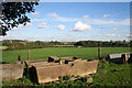
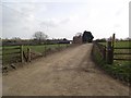
Living in LE19 1ES means inhabiting a compact, residential cluster in England’s East Midlands. The area spans 3.4 hectares and is home to 2,542 residents, creating a close-knit community with a population density of 298 people per square kilometre. This small postcode is defined by its proximity to essential amenities and transport links, making it practical for daily life. The area’s character is shaped by its mix of retail, rail, and metro access, with Sainsburys Fosse and Leicester Railway Station within reach. While the population skews toward adults aged 30–64, the presence of a primary school suggests families are a key demographic. The area’s size and layout mean it is neither sprawling nor isolated, offering a balance between urban convenience and manageable scale. For buyers, this is a place where practicality meets accessibility, with homes primarily in private ownership and no significant environmental constraints. The low flood risk and medium crime score (48/100) indicate a generally stable environment, though standard security measures are advisable.
- Area Type
- Postcode
- Area Size
- 3.4 hectares
- Population
- 2542
- Population Density
- 298 people/km²
The property market in LE19 1ES is characterised by high home ownership (77%) and a predominance of houses, indicating a focus on private, family-oriented living. This small area’s limited size means the housing stock is finite, with few new developments likely. The concentration of houses suggests a market skewed toward owner-occupation rather than rental properties, which may appeal to buyers seeking long-term stability. Given the area’s proximity to retail hubs like Makro Leicester and transport links such as Leicester Railway Station, properties here are likely positioned for convenience. However, the compact nature of the postcode means buyers should consider the immediate surroundings for additional options. The lack of environmental constraints, such as protected woodlands or AONB designations, may also make the area more attractive for those prioritising development flexibility.
House Prices in LE19 1ES
No properties found in this postcode.
Energy Efficiency in LE19 1ES
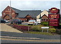
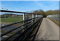
Residents of LE19 1ES have access to a range of amenities within practical reach. The retail sector includes Sainsburys Fosse, M&S Fosse, and Makro Leicester, offering shopping and grocery needs. Transport links such as Leicester Railway Station and Great Central Railway provide connectivity to nearby towns and cities. While the area lacks detailed information on parks or leisure facilities, the presence of multiple retail and transport hubs suggests a lifestyle focused on convenience. The compact size of the postcode means amenities are closely clustered, reducing travel time for daily errands. For those prioritising accessibility, the mix of retail, rail, and metro options creates a functional environment. However, the absence of specific data on green spaces or recreational areas means buyers should investigate further for outdoor amenities.
Amenities
Schools
The nearest school to LE19 1ES is New Lubbesthorpe Primary School, which serves the local community with a good Ofsted rating. This primary school is a key asset for families, offering a reliable education option for younger children. The absence of secondary schools or further education institutions in the immediate vicinity means residents may need to travel slightly further for older children’s schooling. However, the presence of a well-rated primary school suggests the area is family-friendly, with a focus on early education. For parents, this school’s performance is a positive indicator of the local educational infrastructure, though additional research into nearby secondary options would be necessary for long-term planning.
| Rank | School | Type | Entry gender | Ages |
|---|
Explore more schools in this area
Go to Schools tabDemographics
The community in LE19 1ES is predominantly composed of adults aged 30–64, with a median age of 47. This suggests a mature population, likely including professionals and families. Home ownership is high at 77%, indicating a stable housing market with a focus on long-term residency. The accommodation type is largely houses, reflecting a residential area suited to family living. The predominant ethnic group is White, which aligns with broader regional demographics. While no specific deprivation data is provided, the high home ownership rate and moderate population density suggest a community with relatively strong economic stability. However, the absence of detailed diversity metrics means the full range of cultural or socioeconomic composition remains unexplored. The age profile implies a mix of established residents and possibly younger families, though the exact proportion of households with children is not specified.
Household Size
Accommodation Type
Tenure
Ethnic Group
Religion
Household Composition
Age
Household Deprivation
NS-SEC
Explore more demographic insights in this area
Go to Demographics tabPlanning
Planning Constraints
- Flood RiskPremium
- Ramsar Wetland SitesPremium
- Area of Outstanding Natural BeautyPremium
- Protected Nature ReservePremium
- Protected WoodlandPremium