Area Overview for LE18 3SJ
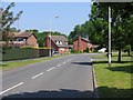
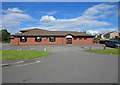
Photos of LE18 3SJ
Area Information
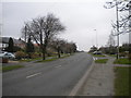
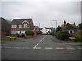
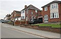
Living in LE18 3SJ means inhabiting a compact, densely populated residential cluster in England. The area spans just 2.4 hectares, yet it accommodates 1,378 residents, resulting in a population density of 57,073 people per square kilometre. This high density reflects a mature community, with a median age of 47 and a majority of residents aged 30–64. The area is characterised by its focus on home ownership, with 81% of households owning their properties. Most homes are houses, not flats, which is uncommon in such a small postcode. Daily life here is shaped by proximity to essential services, including two rail stations and a nearby supermarket. The area’s small size means residents are close to local amenities, though its limited footprint means the surrounding neighbourhoods are key for broader access. LE18 3SJ is not a sprawling suburb but a tightly knit cluster where community ties are likely strong, given the demographic profile.
- Area Type
- Postcode
- Area Size
- 2.4 hectares
- Population
- 1378
- Population Density
- 4682 people/km²
The property market in LE18 3SJ is defined by high home ownership, with 81% of residents owning their homes. This suggests a stable, long-term demographic rather than a transient rental market. The area’s housing stock is dominated by houses, not flats, which is unusual for a small postcode but may reflect the local preference for single-family homes. Given the area’s compact size—just 2.4 hectares—buyers should consider the immediate surroundings for broader housing options. The high population density implies that properties here are likely to be in close proximity to one another, with limited land for new developments. For buyers, this means focusing on the existing stock, which may offer characterful homes in a tightly knit community. The lack of flats also means the area is less likely to cater to students or young professionals seeking rental properties.
House Prices in LE18 3SJ
Showing 47 properties
| Address | Type | Beds | Baths | Last Sale Price | Last Sale Date | |
|---|---|---|---|---|---|---|
| 58 Stanhope Road, Wigston, LE18 3SJ | Detached | 4 | 2 | £440,000 | Mar 2025 | |
| 1 Stanhope Road, Wigston, LE18 3SJ | Bungalow | 3 | 1 | £375,500 | Oct 2024 | |
| 2 Stanhope Road, Wigston, LE18 3SJ | Bungalow | 2 | 1 | £335,000 | May 2024 | |
| 40 Stanhope Road, Wigston, LE18 3SJ | Retail | 2 | 1 | £350,000 | Aug 2022 | |
| 46 Stanhope Road, Wigston, LE18 3SJ | Detached | 5 | - | £367,500 | Jun 2020 | |
| 3 Stanhope Road, Wigston, LE18 3SJ | Bungalow | 2 | 1 | £286,000 | Jun 2019 | |
| 33 Stanhope Road, Wigston, LE18 3SJ | Detached | 5 | 3 | £370,000 | May 2019 | |
| 24 Stanhope Road, Wigston, LE18 3SJ | house | - | - | £218,000 | Apr 2019 | |
| 21 Stanhope Road, Wigston, LE18 3SJ | Detached | 4 | - | £377,500 | Sep 2018 | |
| 8 Stanhope Road, Wigston, LE18 3SJ | Semi-detached | 3 | - | £216,500 | Aug 2018 |
Energy Efficiency in LE18 3SJ
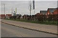
Residents of LE18 3SJ have access to a range of practical amenities within walking or short driving distance. The area includes five retail outlets, such as Morrisons Daily, Sainsburys Wigston, and Aldi Wigston, ensuring everyday shopping needs are met. Two rail stations—South Wigston and Leicester—provide convenient access to public transport, while Leicester Airport is nearby for regional travel. The absence of major parks or leisure facilities in the data suggests that residents may need to look to adjacent areas for recreational spaces. Nonetheless, the proximity to supermarkets, rail links, and an airport contributes to a functional lifestyle, supporting both daily errands and broader connectivity. The compact nature of the area means amenities are concentrated, which can be both a convenience and a limitation depending on individual needs.
Amenities
Schools
| Rank | School | Type | Entry gender | Ages |
|---|
Explore more schools in this area
Go to Schools tabDemographics
The community in LE18 3SJ is predominantly composed of adults aged 30–64, with a median age of 47. This suggests a stable, middle-aged population, many of whom are likely in their prime working years or nearing retirement. Home ownership is high at 81%, indicating a strong presence of long-term residents rather than renters. The area is dominated by houses, not flats, which aligns with the demographic’s preference for family-friendly or established living. The predominant ethnic group is White, though no data is provided on other groups. The high population density—57,073 people per square kilometre—suggests a mix of household types, though specific figures on family structures or deprivation levels are not included. This density may influence the character of the area, with limited space for expansion but a focus on existing residential infrastructure.
Household Size
Accommodation Type
Tenure
Ethnic Group
Religion
Household Composition
Age
Household Deprivation
NS-SEC
Explore more demographic insights in this area
Go to Demographics tabPlanning
Planning Constraints
- Flood RiskPremium
- Ramsar Wetland SitesPremium
- Area of Outstanding Natural BeautyPremium
- Protected Nature ReservePremium
- Protected WoodlandPremium