Area Overview for LE17 4UW
Photos of LE17 4UW
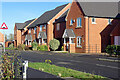
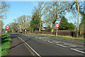
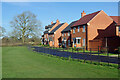
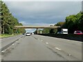

13 photos from this area
Area Information
Key information about the LE17 4UW including its size, population, and administrative classification.
- Area Type
- Postcode
- Area Size
- 3.2 hectares
- Population
- 1646
- Population Density
- 835 people/km²
House Prices in LE17 4UW
50
Properties
£300,691
Average Sold Price
£192,000
Lowest Price
£605,217
Highest Price
Showing 50 properties
| Address | Type | Beds | Baths | Last Sale Price | Last Sale Date | |
|---|---|---|---|---|---|---|
| 35 Poppy Road, Lutterworth, LE17 4UW | house | - | - | £306,000 | Jul 2025 | |
| 25 Poppy Road, Lutterworth, LE17 4UW | house | - | - | £280,000 | Feb 2025 | |
| 46 Poppy Road, Lutterworth, LE17 4UW | Semi-detached | 3 | 2 | £300,000 | Jun 2024 | |
| 40 Poppy Road, Lutterworth, LE17 4UW | Semi-detached | 2 | 1 | £255,000 | Oct 2023 | |
| 36 Poppy Road, Lutterworth, LE17 4UW | Detached | 4 | 3 | £395,000 | Mar 2022 | |
| 58 Poppy Road, Lutterworth, LE17 4UW | Semi-detached | 3 | 1 | £302,499 | Sep 2021 | |
| 27 Poppy Road, Lutterworth, LE17 4UW | Retail | 3 | 2 | £250,000 | Dec 2020 | |
| 30 Poppy Road, Lutterworth, LE17 4UW | house | - | - | £240,000 | Dec 2020 | |
| 26 Poppy Road, Lutterworth, LE17 4UW | house | 4 | 2 | £317,500 | Jun 2020 | |
| 8 Poppy Road, Lutterworth, LE17 4UW | Detached | 3 | 1 | £277,500 | Nov 2019 |
Page 1 of 5
Energy Efficiency in LE17 4UW
Amenities
Schools
| Rank | School | Type | Entry gender | Ages |
|---|
Explore more schools in this area
Go to Schools tabDemographics
Household Size
Family (3-5 people)
most common
Accommodation Type
Houses
most common
Tenure
85
majority
Ethnic Group
White
most common
Religion
N/A
most common
Household Composition
N/A
most common
Age
47
median
Adults (30-64 years)
most common
Household Deprivation
N/A
with no deprivation
NS-SEC
49
in Lower managerial occupations
Explore more demographic insights in this area
Go to Demographics tabPlanning
Planning Constraints
- Flood RiskPremium
- Ramsar Wetland SitesPremium
- Area of Outstanding Natural BeautyPremium
- Protected Nature ReservePremium
- Protected WoodlandPremium