Area Overview for LE17 4UA
Photos of LE17 4UA
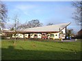
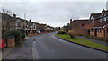
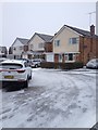
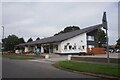
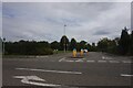
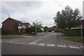
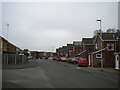
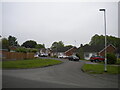


16 photos from this area
Area Information
Key information about the LE17 4UA including its size, population, and administrative classification.
- Area Type
- Postcode
- Area Size
- 5718 m²
- Population
- 2546
- Population Density
- 3070 people/km²
House Prices in LE17 4UA
17
Properties
£143,568
Average Sold Price
£54,000
Lowest Price
£245,000
Highest Price
Showing 17 properties
| Address | Type | Beds | Baths | Last Sale Price | Last Sale Date | |
|---|---|---|---|---|---|---|
| 8 Cedar Avenue, Lutterworth, LE17 4UA | Terraced | 3 | 1 | £245,000 | Jul 2025 | |
| 9 Cedar Avenue, Lutterworth, LE17 4UA | house | - | - | £215,000 | Dec 2021 | |
| 7 Cedar Avenue, Lutterworth, LE17 4UA | Terraced | 3 | 1 | £179,000 | Dec 2020 | |
| 11 Cedar Avenue, Lutterworth, LE17 4UA | Terraced | 3 | 1 | £153,000 | Jun 2015 | |
| 16 Cedar Avenue, Lutterworth, LE17 4UA | Terraced | 2 | 1 | £125,000 | Feb 2014 | |
| 4 Cedar Avenue, Lutterworth, LE17 4UA | house | 3 | - | £155,000 | Aug 2011 | |
| 14 Cedar Avenue, Lutterworth, LE17 4UA | house | - | - | £130,750 | Apr 2010 | |
| 13 Cedar Avenue, Lutterworth, LE17 4UA | Terraced | - | - | £136,000 | Sep 2009 | |
| 10 Cedar Avenue, Lutterworth, LE17 4UA | house | - | - | £128,500 | Jun 2004 | |
| 1 Cedar Avenue, Lutterworth, LE17 4UA | Semi-detached | - | - | £58,000 | Nov 1995 |
Page 1 of 2
Energy Efficiency in LE17 4UA
Amenities
Schools
| Rank | School | Type | Entry gender | Ages |
|---|
Explore more schools in this area
Go to Schools tabDemographics
Household Size
Two person
most common
Accommodation Type
Houses
most common
Tenure
88
majority
Ethnic Group
White
most common
Religion
N/A
most common
Household Composition
N/A
most common
Age
47
median
Adults (30-64 years)
most common
Household Deprivation
N/A
with no deprivation
NS-SEC
44
in Lower managerial occupations
Explore more demographic insights in this area
Go to Demographics tabPlanning
Planning Constraints
- Flood RiskPremium
- Ramsar Wetland SitesPremium
- Area of Outstanding Natural BeautyPremium
- Protected Nature ReservePremium
- Protected WoodlandPremium