Area Overview for LE17 4SE
Photos of LE17 4SE
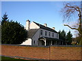
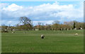
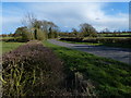
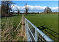
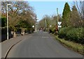
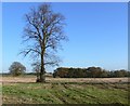
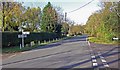
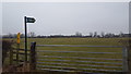
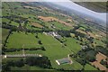
9 photos from this area
Area Information
Key information about the LE17 4SE including its size, population, and administrative classification.
- Area Type
- Postcode
- Area Size
- 6.8 hectares
- Population
- 2557
- Population Density
- 109 people/km²
House Prices in LE17 4SE
12
Properties
£465,469
Average Sold Price
£200,000
Lowest Price
£850,000
Highest Price
Showing 12 properties
| Address | Type | Beds | Baths | Last Sale Price | Last Sale Date | |
|---|---|---|---|---|---|---|
| West End Farm, West End, Bitteswell, LE17 4SE | Detached | 4 | 4 | £850,000 | Jan 2025 | |
| Green Farm, West End, Bitteswell, LE17 4SE | house | 5 | 3 | £755,000 | Sep 2024 | |
| Pound House, West End, Bitteswell, LE17 4SE | Detached | 4 | 4 | £673,000 | Mar 2022 | |
| West End Cottage, West End, Bitteswell, LE17 4SE | Cottage | 2 | 4 | £225,000 | Apr 2021 | |
| Norland House, West End, Bitteswell, LE17 4SE | Detached | - | - | £560,000 | Nov 2007 | |
| The Old Forge, West End, Bitteswell, LE17 4SE | Detached | - | - | £200,000 | Aug 2001 | |
| Croft Cottage, West End, Bitteswell, LE17 4SE | Detached | 4 | 2 | £245,000 | Jun 2001 | |
| Westendun, West End, Bitteswell, LE17 4SE | Terraced | - | - | £215,750 | Jan 1999 | |
| Meadow View, West End, Bitteswell, LE17 4SE | Detached | - | - | - | - | |
| Barnside, West End, Bitteswell, LE17 4SE | house | - | - | - | - |
Page 1 of 2
Energy Efficiency in LE17 4SE
Amenities
Schools
| Rank | School | Type | Entry gender | Ages |
|---|
Explore more schools in this area
Go to Schools tabDemographics
Household Size
Two person
most common
Accommodation Type
Houses
most common
Tenure
80
majority
Ethnic Group
White
most common
Religion
N/A
most common
Household Composition
N/A
most common
Age
47
median
Adults (30-64 years)
most common
Household Deprivation
N/A
with no deprivation
NS-SEC
43
in Lower managerial occupations
Explore more demographic insights in this area
Go to Demographics tabPlanning
Planning Constraints
- Flood RiskPremium
- Ramsar Wetland SitesPremium
- Area of Outstanding Natural BeautyPremium
- Protected Nature ReservePremium
- Protected WoodlandPremium