Area Overview for LE17 4JR
Photos of LE17 4JR
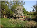
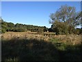
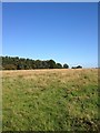
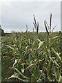
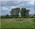
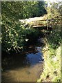
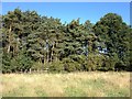
7 photos from this area
Area Information
Key information about the LE17 4JR including its size, population, and administrative classification.
- Area Type
- Postcode
- Area Size
- 14.6 hectares
- Population
- 2982
- Population Density
- 59 people/km²
House Prices in LE17 4JR
39
Properties
£278,656
Average Sold Price
£73,000
Lowest Price
£765,000
Highest Price
Showing 39 properties
| Address | Type | Beds | Baths | Last Sale Price | Last Sale Date | |
|---|---|---|---|---|---|---|
| 18 Brook Street, Walcote, LE17 4JR | Detached | 4 | 2 | £385,000 | Mar 2024 | |
| 32 Brook Street, Walcote, LE17 4JR | Detached | 5 | 2 | £765,000 | May 2023 | |
| 21 Brook Street, Walcote, LE17 4JR | Bungalow | 3 | 1 | £244,000 | Nov 2022 | |
| 16 Brook Street, Walcote, LE17 4JR | Retail | 4 | 2 | £405,000 | May 2022 | |
| 14 Brook Street, Walcote, LE17 4JR | Bungalow | 3 | - | £399,000 | Apr 2021 | |
| 27 Brook Street, Walcote, LE17 4JR | Bungalow | 4 | 1 | £325,000 | Apr 2021 | |
| Yew Tree House, 25 Brook Street, Walcote, LE17 4JR | Detached | 6 | - | £565,000 | Dec 2020 | |
| Stanwell Lodge, 29 Brook Street, Walcote, LE17 4JR | Detached | 4 | 1 | £309,000 | Nov 2017 | |
| 30 Brook Street, Walcote, LE17 4JR | Bungalow | 3 | - | £325,000 | Oct 2017 | |
| 8 Brook Street, Walcote, LE17 4JR | house | - | - | £157,000 | Apr 2017 |
Page 1 of 4
Energy Efficiency in LE17 4JR
Amenities
Schools
| Rank | School | Type | Entry gender | Ages |
|---|
Explore more schools in this area
Go to Schools tabDemographics
Household Size
Two person
most common
Accommodation Type
Houses
most common
Tenure
80
majority
Ethnic Group
White
most common
Religion
N/A
most common
Household Composition
N/A
most common
Age
47
median
Adults (30-64 years)
most common
Household Deprivation
N/A
with no deprivation
NS-SEC
46
in Lower managerial occupations
Explore more demographic insights in this area
Go to Demographics tabPlanning
Planning Constraints
- Flood RiskPremium
- Ramsar Wetland SitesPremium
- Area of Outstanding Natural BeautyPremium
- Protected Nature ReservePremium
- Protected WoodlandPremium