Area Overview for LE17 4HZ
Photos of LE17 4HZ

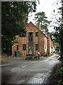
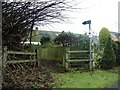
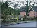


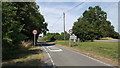
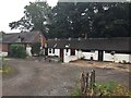
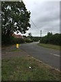
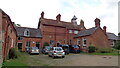
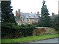
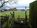
25 photos from this area
Area Information
Key information about the LE17 4HZ including its size, population, and administrative classification.
- Area Type
- Postcode
- Area Size
- 68.3 hectares
- Population
- 2982
- Population Density
- 59 people/km²
House Prices in LE17 4HZ
42
Properties
£364,090
Average Sold Price
£76,000
Lowest Price
£760,000
Highest Price
Showing 42 properties
| Address | Type | Beds | Baths | Last Sale Price | Last Sale Date | |
|---|---|---|---|---|---|---|
| The Spinney, Main Street, Cotesbach, LE17 4HZ | Bungalow | 3 | 2 | £760,000 | Oct 2024 | |
| Dormer House, Main Street, Cotesbach, LE17 4HZ | Detached | 4 | 3 | £655,000 | Oct 2024 | |
| Ash Bank, Main Street, Cotesbach, LE17 4HZ | Retail | 3 | 3 | £563,000 | Sep 2022 | |
| Avalon, Main Street, Cotesbach, LE17 4HZ | house | - | - | £365,000 | Apr 2022 | |
| Rectory Cottage, Main Street, Cotesbach, LE17 4HZ | Cottage | 2 | 2 | £270,000 | May 2021 | |
| Orchard House, Main Street, Cotesbach, LE17 4HZ | Detached | 6 | 3 | £722,500 | Mar 2021 | |
| Armdale, Main Street, Cotesbach, LE17 4HZ | Retail | 4 | 2 | £350,000 | Jan 2021 | |
| Holmleigh Farm, Main Street, Cotesbach, LE17 4HZ | house | - | - | £494,500 | Jan 2021 | |
| Hill Side, Main Street, Cotesbach, LE17 4HZ | Detached | 4 | 2 | £560,000 | Mar 2020 | |
| Pompleton House, Main Street, Cotesbach, LE17 4HZ | Retail | 4 | 3 | £295,000 | Aug 2019 |
Page 1 of 5
Energy Efficiency in LE17 4HZ
Amenities
Schools
| Rank | School | Type | Entry gender | Ages |
|---|
Explore more schools in this area
Go to Schools tabDemographics
Household Size
Two person
most common
Accommodation Type
Houses
most common
Tenure
80
majority
Ethnic Group
White
most common
Religion
N/A
most common
Household Composition
N/A
most common
Age
47
median
Adults (30-64 years)
most common
Household Deprivation
N/A
with no deprivation
NS-SEC
46
in Lower managerial occupations
Explore more demographic insights in this area
Go to Demographics tabPlanning
Planning Constraints
- Flood RiskPremium
- Ramsar Wetland SitesPremium
- Area of Outstanding Natural BeautyPremium
- Protected Nature ReservePremium
- Protected WoodlandPremium