Area Overview for LE17 4EX
Photos of LE17 4EX
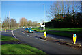
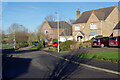
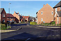
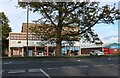
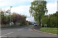
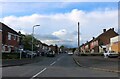
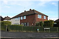
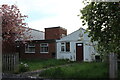
23 photos from this area
Area Information
Key information about the LE17 4EX including its size, population, and administrative classification.
- Area Type
- Postcode
- Area Size
- 4.7 hectares
- Population
- 2158
- Population Density
- 1003 people/km²
House Prices in LE17 4EX
13
Properties
£339,450
Average Sold Price
£120,000
Lowest Price
£675,000
Highest Price
Showing 13 properties
| Address | Type | Beds | Baths | Last Sale Price | Last Sale Date | |
|---|---|---|---|---|---|---|
| Heathercroft, Bitteswell Road, Lutterworth, LE17 4EX | house | - | - | £675,000 | Apr 2021 | |
| 54 Bitteswell Road, Lutterworth, LE17 4EX | Bungalow | 3 | 1 | £418,000 | May 2019 | |
| 44A Bitteswell Road, Lutterworth, LE17 4EX | Detached | 3 | 1 | £415,000 | May 2018 | |
| 50 Bitteswell Road, Lutterworth, LE17 4EX | Detached | 5 | - | £550,000 | Jul 2017 | |
| 40 Bitteswell Road, Lutterworth, LE17 4EX | Terraced | 3 | 2 | £280,000 | Jan 2017 | |
| 52 Bitteswell Road, Lutterworth, LE17 4EX | house | - | - | £390,000 | Oct 2012 | |
| 44 Bitteswell Road, Lutterworth, LE17 4EX | Terraced | - | - | £320,000 | Aug 2012 | |
| 46 Bitteswell Road, Lutterworth, LE17 4EX | Semi-detached | - | - | £221,000 | Aug 2004 | |
| 42 Bitteswell Road, Lutterworth, LE17 4EX | Terraced | - | - | £150,000 | Apr 2002 | |
| 56 Bitteswell Road, Lutterworth, LE17 4EX | house | - | - | £194,950 | Nov 2000 |
Page 1 of 2
Energy Efficiency in LE17 4EX
Amenities
Schools
| Rank | School | Type | Entry gender | Ages |
|---|
Explore more schools in this area
Go to Schools tabDemographics
Household Size
One person
most common
Accommodation Type
Houses
most common
Tenure
59
majority
Ethnic Group
White
most common
Religion
N/A
most common
Household Composition
N/A
most common
Age
47
median
Adults (30-64 years)
most common
Household Deprivation
N/A
with no deprivation
NS-SEC
35
in Lower managerial occupations
Explore more demographic insights in this area
Go to Demographics tabPlanning
Planning Constraints
- Flood RiskPremium
- Ramsar Wetland SitesPremium
- Area of Outstanding Natural BeautyPremium
- Protected Nature ReservePremium
- Protected WoodlandPremium