Area Overview for LE16 9ZS
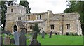
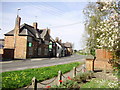
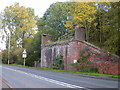
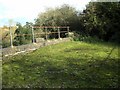
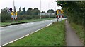
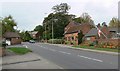
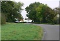
Photos of LE16 9ZS


Area Information
Living in LE16 9ZS offers a quiet, compact residential experience in a small cluster of homes. With a population of 2031 and a density of 192 people per square kilometre, the area feels intentionally modest, avoiding the pressures of larger urban centres. It is a place where families and professionals coexist, supported by nearby schools and essential services. The proximity to Lubenham All Saints Church of England Primary School and Wellington Place Primary School ensures children have access to education within walking distance. While the area is small, it is well-connected to Market Harborough Railway Station, offering commuter links to nearby towns. The low flood risk and absence of protected natural sites suggest a stable, low-constraint environment. However, the medium crime risk score of 56 means residents should maintain standard security measures. For those seeking a balanced life with practical amenities and a manageable pace, LE16 9ZS provides a foundation of simplicity and accessibility.
- Area Type
- Postcode
- Area Size
- Not available
- Population
- 2031
- Population Density
- 192 people/km²
The property market in LE16 9ZS is defined by high home ownership (79%) and a focus on houses rather than flats or apartments. This suggests a community of homeowners with long-term commitments, likely prioritising family-friendly housing over rental properties. The absence of flats indicates a lack of high-density development, which may limit options for buyers seeking smaller or more affordable units. Given the area’s small size, the housing stock is likely limited to individual properties rather than large estates or commercial developments. For buyers, this means a market where properties are likely to be owner-occupied, with fewer opportunities for investment in rental portfolios. The emphasis on houses also implies a need for buyers to consider larger plots or suburban-style living, which may not suit those preferring urban or compact housing.
House Prices in LE16 9ZS
No properties found in this postcode.
Energy Efficiency in LE16 9ZS
The lifestyle in LE16 9ZS is shaped by its proximity to essential retail and transport hubs. Five retail outlets are within practical reach, including Spar, Co-op Leicester, and Co-op Petrol, offering everyday shopping and fuel needs. The Market Harborough Railway Station provides access to nearby towns and cities, supporting both commuter and leisure travel. While the area lacks detailed data on parks or leisure facilities, the presence of local shops and a rail link suggests a practical, low-maintenance lifestyle. The compact nature of the area means amenities are concentrated, reducing the need for long commutes. However, residents may need to travel further for specialist services or entertainment, which is a common trade-off in smaller communities. The balance of convenience and simplicity defines daily life here.
Amenities
Schools
Residents of LE16 9ZS have access to two primary schools: Lubenham All Saints Church of England Primary School, which holds an Ofsted rating of ‘good’, and Wellington Place Primary School. Both institutions cater to younger children, providing a foundation for early education within walking distance. The presence of two primary schools suggests a focus on local schooling, though no secondary schools are listed in the data. For families, this means proximity to primary education is a strength, but they may need to travel further for secondary schooling. The ‘good’ rating at Lubenham All Saints indicates a school meeting acceptable standards, though parents should research additional factors like curriculum or extracurricular offerings. The overall school mix supports families seeking convenience but may require planning for older children’s education.
| Rank | School | Type | Entry gender | Ages |
|---|
Explore more schools in this area
Go to Schools tabDemographics
The community in LE16 9ZS is predominantly composed of adults aged 30–64, with a median age of 47. This suggests a mature population, likely including professionals and families with established careers. Home ownership is high, at 79%, indicating a stable, long-term resident base. The accommodation type is primarily houses, which aligns with the area’s low density and residential character. The predominant ethnic group is White, reflecting a homogenous demographic profile. While no specific deprivation data is provided, the high home ownership rate and age distribution suggest a community with relatively stable economic conditions. This demographic structure may appeal to those seeking a settled environment with minimal turnover, though it also means the area lacks the diversity of younger or more transient populations.
Household Size
Accommodation Type
Tenure
Ethnic Group
Religion
Household Composition
Age
Household Deprivation
NS-SEC
Explore more demographic insights in this area
Go to Demographics tabPlanning
Planning Constraints
- Flood RiskPremium
- Ramsar Wetland SitesPremium
- Area of Outstanding Natural BeautyPremium
- Protected Nature ReservePremium
- Protected WoodlandPremium