Area Overview for LE16 9RX
Photos of LE16 9RX
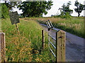
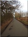

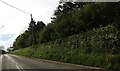
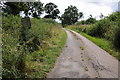
5 photos from this area
Area Information
Key information about the LE16 9RX including its size, population, and administrative classification.
- Area Type
- Postcode
- Area Size
- 1.6 km²
- Population
- 2289
- Population Density
- 39 people/km²
House Prices in LE16 9RX
45
Properties
£370,458
Average Sold Price
£40,000
Lowest Price
£755,000
Highest Price
Showing 45 properties
| Address | Type | Beds | Baths | Last Sale Price | Last Sale Date | |
|---|---|---|---|---|---|---|
| The Hawthorns, Kelmarsh Road, Clipston, LE16 9RX | Detached | 4 | 3 | £755,000 | Sep 2025 | |
| 39 Kelmarsh Road, Clipston, LE16 9RX | Terraced | 3 | 1 | £275,000 | May 2025 | |
| Little Orchard, Kelmarsh Road, Clipston, LE16 9RX | house | - | - | £636,000 | Jul 2024 | |
| Hillside, Kelmarsh Road, Clipston, LE16 9RX | house | - | - | £525,000 | Jul 2024 | |
| 5 Kelmarsh Road, Clipston, LE16 9RX | house | 3 | 1 | £273,750 | Jan 2024 | |
| 41 Kelmarsh Road, Clipston, LE16 9RX | Terraced | 2 | 1 | £235,000 | Jan 2023 | |
| Lamorna, Kelmarsh Road, Clipston, LE16 9RX | Bungalow | - | - | £335,000 | Nov 2021 | |
| 15 Kelmarsh Road, Clipston, LE16 9RX | house | - | - | £386,250 | Sep 2021 | |
| 15A Kelmarsh Road, Clipston, LE16 9RX | Detached | 4 | 1 | £465,000 | Aug 2021 | |
| Springhill, Kelmarsh Road, Clipston, LE16 9RX | house | - | - | £365,000 | Jul 2020 |
Page 1 of 5
Energy Efficiency in LE16 9RX
Amenities
Schools
| Rank | School | Type | Entry gender | Ages |
|---|
Explore more schools in this area
Go to Schools tabDemographics
Household Size
Two person
most common
Accommodation Type
Houses
most common
Tenure
79
majority
Ethnic Group
White
most common
Religion
N/A
most common
Household Composition
N/A
most common
Age
47
median
Adults (30-64 years)
most common
Household Deprivation
N/A
with no deprivation
NS-SEC
47
in Lower managerial occupations
Explore more demographic insights in this area
Go to Demographics tabPlanning
Planning Constraints
- Flood RiskPremium
- Ramsar Wetland SitesPremium
- Area of Outstanding Natural BeautyPremium
- Protected Nature ReservePremium
- Protected WoodlandPremium