Area Overview for LE15 9TX
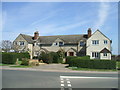
Photos of LE15 9TX
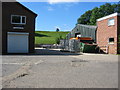
![Uppingham buildings [33] in LE15 9TX](https://images.propbar.co.uk/images/geograph/71/44/7144508_120.jpg)
![Uppingham buildings [34] in LE15 9TX](https://images.propbar.co.uk/images/geograph/71/44/7144511_120.jpg)


15 photos from this area
Area Information
Key information about the LE15 9TX including its size, population, and administrative classification.
- Area Type
- Postcode
- Area Size
- 23.1 hectares
- Population
- 1285
- Population Density
- 841 people/km²
House Prices in LE15 9TX
25
Properties
£429,259
Average Sold Price
£123,000
Lowest Price
£725,000
Highest Price
Showing 25 properties
| Address | Type | Beds | Baths | Last Sale Price | Last Sale Date | |
|---|---|---|---|---|---|---|
| Magnolia Cottage, 3 Station Road, Uppingham, LE15 9TX | Detached | 3 | 2 | £290,000 | May 2020 | |
| Little Orchard, 6 Station Road, Uppingham, LE15 9TX | Detached | 3 | 3 | £725,000 | Feb 2017 | |
| Robin Hill, 2A Station Road, Uppingham, LE15 9TX | Detached | 5 | 2 | £700,000 | Mar 2016 | |
| Valant House, 8A Station Road, Uppingham, LE15 9TX | Detached | - | - | £412,000 | Aug 2004 | |
| Meadowsweet, 8 Station Road, Uppingham, LE15 9TX | Detached | - | - | £325,553 | Aug 2001 | |
| Rosebank Cottage, 5 Station Road, Uppingham, LE15 9TX | Detached | - | - | £123,000 | Aug 1998 | |
| 7, Hillside, Station Road, Uppingham, LE15 9TX | Maisonette | 3 | 1 | - | - | |
| 10A Station Road, Uppingham, LE15 9TX | Industrial | - | - | - | - | |
| 1, Hillside, Station Road, Uppingham, LE15 9TX | Industrial | - | - | - | - | |
| 5, Hillside, Station Road, Uppingham, LE15 9TX | Maisonette | - | - | - | - |
Page 1 of 3
Energy Efficiency in LE15 9TX
Amenities
Schools
| Rank | School | Type | Entry gender | Ages |
|---|
Explore more schools in this area
Go to Schools tabDemographics
Household Size
One person
most common
Accommodation Type
Houses
most common
Tenure
68
majority
Ethnic Group
White
most common
Religion
N/A
most common
Household Composition
N/A
most common
Age
47
median
Adults (30-64 years)
most common
Household Deprivation
N/A
with no deprivation
NS-SEC
43
in Lower managerial occupations
Explore more demographic insights in this area
Go to Demographics tabPlanning
Planning Constraints
- Flood RiskPremium
- Ramsar Wetland SitesPremium
- Area of Outstanding Natural BeautyPremium
- Protected Nature ReservePremium
- Protected WoodlandPremium