Area Overview for LE15 9SB
Photos of LE15 9SB
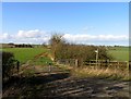
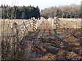
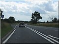
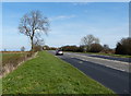
19 photos from this area
Area Information
Key information about the LE15 9SB including its size, population, and administrative classification.
- Area Type
- Postcode
- Area Size
- 74.4 hectares
- Population
- 1614
- Population Density
- 1032 people/km²
House Prices in LE15 9SB
14
Properties
£340,014
Average Sold Price
£15,000
Lowest Price
£685,000
Highest Price
Showing 14 properties
| Address | Type | Beds | Baths | Last Sale Price | Last Sale Date | |
|---|---|---|---|---|---|---|
| 11 Leicester Road, Uppingham, LE15 9SB | house | 1 | 1 | £600,000 | Jul 2024 | |
| 7 Leicester Road, Uppingham, LE15 9SB | Semi-detached | 5 | 2 | £685,000 | Jul 2021 | |
| The Barn, 19A Leicester Road, Uppingham, LE15 9SB | house | - | - | £297,500 | Nov 2016 | |
| 5 Leicester Road, Uppingham, LE15 9SB | house | - | - | £250,000 | Sep 2016 | |
| Dunedin, Leicester Road, Uppingham, LE15 9SB | Semi-detached | 3 | 2 | £357,500 | Oct 2002 | |
| 9 Leicester Road, Uppingham, LE15 9SB | Semi-detached | - | - | £175,100 | Aug 2002 | |
| 13 Leicester Road, Uppingham, LE15 9SB | house | 4 | 2 | £15,000 | Mar 1998 | |
| 17 Leicester Road, Uppingham, LE15 9SB | Detached | - | - | - | - | |
| The Exeter Arms, 3 Leicester Road, Uppingham, LE15 9SB | Leisure | - | - | - | - | |
| 1 Leicester Road, Uppingham, LE15 9SB | house | - | - | - | - |
Page 1 of 2
Energy Efficiency in LE15 9SB
Amenities
Schools
| Rank | School | Type | Entry gender | Ages |
|---|
Explore more schools in this area
Go to Schools tabDemographics
Household Size
Two person
most common
Accommodation Type
Houses
most common
Tenure
61
majority
Ethnic Group
White
most common
Religion
N/A
most common
Household Composition
N/A
most common
Age
47
median
Adults (30-64 years)
most common
Household Deprivation
N/A
with no deprivation
NS-SEC
38
in Lower managerial occupations
Explore more demographic insights in this area
Go to Demographics tabPlanning
Planning Constraints
- Flood RiskPremium
- Ramsar Wetland SitesPremium
- Area of Outstanding Natural BeautyPremium
- Protected Nature ReservePremium
- Protected WoodlandPremium