Area Overview for LE15 9PY
Photos of LE15 9PY
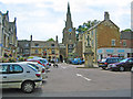

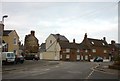

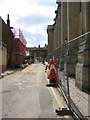


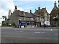

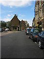

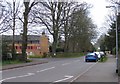
100 photos from this area
Area Information
Key information about the LE15 9PY including its size, population, and administrative classification.
- Area Type
- Postcode
- Area Size
- 1.5 hectares
- Population
- 1826
- Population Density
- 389 people/km²
House Prices in LE15 9PY
53
Properties
£323,182
Average Sold Price
£89,000
Lowest Price
£630,000
Highest Price
Showing 53 properties
| Address | Type | Beds | Baths | Last Sale Price | Last Sale Date | |
|---|---|---|---|---|---|---|
| 61 High Street East, Uppingham, LE15 9PY | Semi-detached | 3 | 3 | £507,000 | Sep 2023 | |
| 71A High Street East, Uppingham, LE15 9PY | Flat | - | - | £170,000 | Jun 2021 | |
| 59 High Street East, Uppingham, LE15 9PY | Detached | 4 | 1 | £630,000 | Mar 2016 | |
| 71 High Street East, Uppingham, LE15 9PY | Maisonette | - | - | £89,000 | Jan 2015 | |
| Stonehurst, 57 High Street East, Uppingham, LE15 9PY | Semi-detached | 6 | - | £415,000 | Sep 2014 | |
| Roselawn, 63 High Street East, Uppingham, LE15 9PY | house | 4 | - | £450,000 | Sep 2011 | |
| Sundial House, 45 High Street East, Uppingham, LE15 9PY | Semi-detached | 5 | 4 | £475,000 | Apr 2007 | |
| 73 High Street East, Uppingham, LE15 9PY | Terraced | 2 | 1 | £160,000 | May 2004 | |
| 67 High Street East, Uppingham, LE15 9PY | Semi-detached | - | - | £425,000 | Apr 2003 | |
| 75 High Street East, Uppingham, LE15 9PY | Cottage | 3 | 1 | £94,000 | Jun 2000 |
Page 1 of 6
Energy Efficiency in LE15 9PY
Amenities
Schools
| Rank | School | Type | Entry gender | Ages |
|---|
Explore more schools in this area
Go to Schools tabDemographics
Household Size
One person
most common
Accommodation Type
Houses
most common
Tenure
70
majority
Ethnic Group
White
most common
Religion
N/A
most common
Household Composition
N/A
most common
Age
22
median
Young Adults (15-29 years)
most common
Household Deprivation
N/A
with no deprivation
NS-SEC
32
in Lower managerial occupations
Explore more demographic insights in this area
Go to Demographics tabPlanning
Planning Constraints
- Flood RiskPremium
- Ramsar Wetland SitesPremium
- Area of Outstanding Natural BeautyPremium
- Protected Nature ReservePremium
- Protected WoodlandPremium