Area Overview for LE15 7NJ
Photos of LE15 7NJ
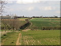
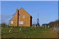

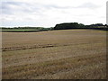
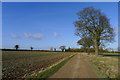
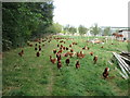
8 photos from this area
Area Information
Key information about the LE15 7NJ including its size, population, and administrative classification.
- Area Type
- Postcode
- Area Size
- 1.4 km²
- Population
- 2474
- Population Density
- 58 people/km²
House Prices in LE15 7NJ
49
Properties
£290,057
Average Sold Price
£18,000
Lowest Price
£770,000
Highest Price
Showing 49 properties
| Address | Type | Beds | Baths | Last Sale Price | Last Sale Date | |
|---|---|---|---|---|---|---|
| Hill House, 81A Main Street, Greetham, LE15 7NJ | Bungalow | 3 | 2 | £544,000 | Mar 2024 | |
| 61 Main Street, Greetham, LE15 7NJ | Cottage | 2 | 1 | £260,000 | Nov 2023 | |
| 85 Main Street, Greetham, LE15 7NJ | Detached | 4 | 2 | £540,000 | Sep 2023 | |
| 45 Main Street, Greetham, LE15 7NJ | Land | 6 | - | £300,000 | Sep 2023 | |
| 67 Main Street, Greetham, LE15 7NJ | Detached | 2 | 1 | £357,500 | Sep 2022 | |
| 65 Main Street, Greetham, LE15 7NJ | Semi-detached | 2 | 1 | £160,000 | Mar 2021 | |
| 1 Main Street, Greetham, LE15 7NJ | Cottage | 4 | 1 | £380,000 | Aug 2020 | |
| 81 Main Street, Greetham, LE15 7NJ | Detached | 2 | 1 | £225,000 | Jul 2019 | |
| Mossfield Cottage, 71 Main Street, Greetham, LE15 7NJ | Semi-detached | 3 | 2 | £282,500 | Apr 2018 | |
| 53 Main Street, Greetham, LE15 7NJ | Cottage | 3 | 2 | £280,000 | Oct 2016 |
Page 1 of 5
Energy Efficiency in LE15 7NJ
Amenities
Schools
| Rank | School | Type | Entry gender | Ages |
|---|
Explore more schools in this area
Go to Schools tabDemographics
Household Size
Two person
most common
Accommodation Type
Houses
most common
Tenure
79
majority
Ethnic Group
White
most common
Religion
N/A
most common
Household Composition
N/A
most common
Age
47
median
Adults (30-64 years)
most common
Household Deprivation
N/A
with no deprivation
NS-SEC
26
in Lower managerial occupations
Explore more demographic insights in this area
Go to Demographics tabPlanning
Planning Constraints
- Flood RiskPremium
- Ramsar Wetland SitesPremium
- Area of Outstanding Natural BeautyPremium
- Protected Nature ReservePremium
- Protected WoodlandPremium