Area Overview for LE15 6QQ
Photos of LE15 6QQ
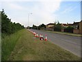
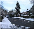
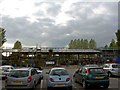
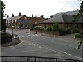

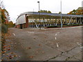
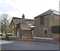
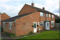
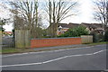
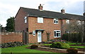
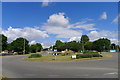
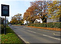
57 photos from this area
Area Information
Key information about the LE15 6QQ including its size, population, and administrative classification.
- Area Type
- Postcode
- Area Size
- 1.5 hectares
- Population
- 1667
- Population Density
- 2804 people/km²
House Prices in LE15 6QQ
15
Properties
£344,217
Average Sold Price
£155,000
Lowest Price
£750,000
Highest Price
Showing 15 properties
| Address | Type | Beds | Baths | Last Sale Price | Last Sale Date | |
|---|---|---|---|---|---|---|
| 54 Ashwell Road, Oakham, LE15 6QQ | house | 4 | 1 | £569,950 | May 2023 | |
| 58 Ashwell Road, Oakham, LE15 6QQ | Detached | 4 | 2 | £750,000 | Aug 2022 | |
| 43 Ashwell Road, Oakham, LE15 6QQ | Semi-detached | 3 | 1 | £261,000 | Sep 2021 | |
| 41 Ashwell Road, Oakham, LE15 6QQ | Semi-detached | 3 | 2 | £175,000 | Feb 2019 | |
| 52 Ashwell Road, Oakham, LE15 6QQ | Terraced | 3 | 1 | £450,000 | Jul 2018 | |
| 45 Ashwell Road, Oakham, LE15 6QQ | Semi-detached | 3 | 2 | £190,000 | Jun 2017 | |
| 56 Ashwell Road, Oakham, LE15 6QQ | house | - | - | £375,000 | May 2008 | |
| 50 Ashwell Road, Oakham, LE15 6QQ | Detached | - | - | £172,000 | Jul 1999 | |
| 60 Ashwell Road, Oakham, LE15 6QQ | Detached | - | - | £155,000 | Jul 1998 | |
| 35 Ashwell Road, Oakham, LE15 6QQ | Semi-detached | - | - | - | - |
Page 1 of 2
Energy Efficiency in LE15 6QQ
Amenities
Schools
| Rank | School | Type | Entry gender | Ages |
|---|
Explore more schools in this area
Go to Schools tabDemographics
Household Size
One person
most common
Accommodation Type
Houses
most common
Tenure
45
majority
Ethnic Group
White
most common
Religion
N/A
most common
Household Composition
N/A
most common
Age
47
median
Adults (30-64 years)
most common
Household Deprivation
N/A
with no deprivation
NS-SEC
30
in Lower managerial occupations
Explore more demographic insights in this area
Go to Demographics tabPlanning
Planning Constraints
- Flood RiskPremium
- Ramsar Wetland SitesPremium
- Area of Outstanding Natural BeautyPremium
- Protected Nature ReservePremium
- Protected WoodlandPremium