Area Overview for LE15 6QD
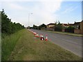
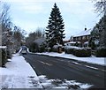
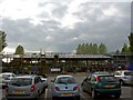
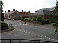
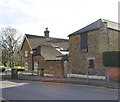
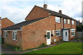
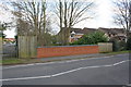
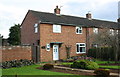
Photos of LE15 6QD


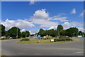
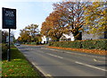
Area Information
Living in LE15 6QD means inhabiting a compact, residential cluster in England, where 1,667 people reside across just 5 hectares. This makes it one of the most densely populated areas in the country, with 33,548 people per square kilometre. Despite its small size, the area offers a mix of practicality and proximity to essential services. The community is predominantly composed of adults aged 30–64, with a median age of 47, suggesting a stable, established population. Daily life here is shaped by the need for efficiency, given the limited space. Residents are likely to be familiar with their immediate surroundings, with local amenities and transport links forming the backbone of daily routines. The area’s proximity to Oakham Railway Station and nearby retail hubs like Lidl and Tesco ensures convenience, while the presence of independent and special schools adds to its appeal for families. However, the high density and small footprint mean that the area is best suited for those prioritising accessibility over expansive living spaces.
- Area Type
- Postcode
- Area Size
- 5.0 hectares
- Population
- 1667
- Population Density
- 2804 people/km²
The property market in LE15 6QD reflects a small, tightly packed residential cluster where 45% of residents own their homes. Given the area’s size—just 5 hectares—and its high population density, housing stock is limited, with houses being the primary accommodation type. This suggests a market characterised by scarcity of available properties, likely driving competition among buyers. The predominance of owner-occupied homes indicates that many residents have long-term ties to the area, possibly due to the proximity of schools and transport links. However, the small footprint of the area means that property availability is constrained, and buyers may need to consider nearby regions for more options. The mix of houses and the high density also implies that properties are likely to be smaller or part of multi-unit developments, catering to a population that values convenience over space.
House Prices in LE15 6QD
Showing 3 properties
| Address | Type | Beds | Baths | Last Sale Price | Last Sale Date | |
|---|---|---|---|---|---|---|
| Oakham School, Housemasters Flat, Buchanans House, Ashwell Road, Oakham, LE15 6QD | Flat | - | - | - | - | |
| Oakham School, Matrons Flat, Buchanans House, Ashwell Road, Oakham, LE15 6QD | Flat | - | - | - | - | |
| Oakham School, Tutors Flat, Buchanans House, Ashwell Road, Oakham, LE15 6QD | Flat | - | - | - | - |
Energy Efficiency in LE15 6QD
The lifestyle in LE15 6QD is defined by its proximity to essential amenities within a small radius. Residents have access to five retail outlets, including Lidl, Morrisons Daily, and Tesco, offering everyday shopping convenience. The presence of RAF Cottesmore airport adds a unique element, though it is likely more relevant for travel than local leisure. The area’s compact nature means that parks and green spaces are not explicitly listed in the data, but the absence of protected natural areas or planning constraints suggests that recreational opportunities may be limited. The mix of retail and transport links supports a practical lifestyle, with a focus on efficiency over expansive leisure options. For those prioritising convenience over space, LE15 6QD provides a self-contained environment with direct access to shopping, transport, and nearby airports.
Amenities
Schools
Residents of LE15 6QD have access to three distinct schools within practical reach. Oakham School and Brooke Priory School are independent institutions, offering fee-paying education with a focus on academic and extracurricular excellence. The Parks School, by contrast, is a special school catering to students with specific educational needs. This combination provides families with options depending on their priorities—whether they seek independent education or support for children requiring tailored learning environments. The presence of both school types suggests a community that values both traditional schooling and inclusive education. However, the absence of state-funded schools in the data means that families without the means for private education may need to look further afield. The proximity of these schools to the area is a key consideration for homebuyers prioritising educational opportunities.
| Rank | School | Type | Entry gender | Ages |
|---|
Explore more schools in this area
Go to Schools tabDemographics
The population of LE15 6QD is largely composed of adults aged 30–64, with a median age of 47. This suggests a mature, settled community, likely with strong ties to local institutions. Home ownership rates stand at 45%, indicating that nearly half of residents own their properties, while the remaining 55% may be renters or in other housing arrangements. The accommodation type is predominantly houses, which is uncommon in densely populated areas, hinting at a mix of traditional and modern housing stock. The predominant ethnic group is White, with no data provided on other demographics. While the area’s high population density (33,548 per km²) could imply a mix of socioeconomic backgrounds, the absence of specific deprivation data means its impact on quality of life remains unclear. The demographic profile suggests a community focused on stability, with limited evidence of transient populations or significant diversity.
Household Size
Accommodation Type
Tenure
Ethnic Group
Religion
Household Composition
Age
Household Deprivation
NS-SEC
Explore more demographic insights in this area
Go to Demographics tabPlanning
Planning Constraints
- Flood RiskPremium
- Ramsar Wetland SitesPremium
- Area of Outstanding Natural BeautyPremium
- Protected Nature ReservePremium
- Protected WoodlandPremium