Area Overview for LE14 4FH
Photos of LE14 4FH
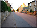

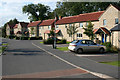

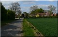
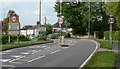
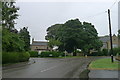
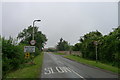
39 photos from this area
Area Information
Key information about the LE14 4FH including its size, population, and administrative classification.
- Area Type
- Postcode
- Area Size
- 1.0 hectares
- Population
- 1793
- Population Density
- 59 people/km²
House Prices in LE14 4FH
22
Properties
£240,071
Average Sold Price
£131,515
Lowest Price
£342,500
Highest Price
Showing 22 properties
| Address | Type | Beds | Baths | Last Sale Price | Last Sale Date | |
|---|---|---|---|---|---|---|
| 7 Speck Close, Waltham On The Wolds, LE14 4FH | house | - | - | £255,000 | Feb 2025 | |
| 1 Speck Close, Waltham On The Wolds, LE14 4FH | house | - | - | £342,500 | Dec 2021 | |
| 5 Speck Close, Waltham On The Wolds, LE14 4FH | Semi-detached | 2 | 1 | £225,000 | Nov 2021 | |
| 2 Speck Close, Waltham On The Wolds, LE14 4FH | house | - | - | £337,500 | Aug 2021 | |
| 6 Speck Close, Waltham On The Wolds, LE14 4FH | house | - | - | £325,000 | Aug 2021 | |
| 4 Speck Close, Waltham On The Wolds, LE14 4FH | house | - | - | £290,000 | Aug 2021 | |
| 10 Speck Close, Waltham On The Wolds, LE14 4FH | Semi-detached | 3 | 1 | £168,330 | Feb 2021 | |
| 19 Speck Close, Waltham On The Wolds, LE14 4FH | house | - | - | £131,515 | Feb 2021 | |
| 25 Speck Close, Waltham On The Wolds, LE14 4FH | house | - | - | £168,330 | Feb 2021 | |
| 23 Speck Close, Waltham On The Wolds, LE14 4FH | house | - | - | £157,535 | Feb 2021 |
Page 1 of 3
Energy Efficiency in LE14 4FH
Amenities
Schools
| Rank | School | Type | Entry gender | Ages |
|---|
Explore more schools in this area
Go to Schools tabDemographics
Household Size
Two person
most common
Accommodation Type
Houses
most common
Tenure
76
majority
Ethnic Group
White
most common
Religion
N/A
most common
Household Composition
N/A
most common
Age
47
median
Adults (30-64 years)
most common
Household Deprivation
N/A
with no deprivation
NS-SEC
42
in Lower managerial occupations
Explore more demographic insights in this area
Go to Demographics tabPlanning
Planning Constraints
- Flood RiskPremium
- Ramsar Wetland SitesPremium
- Area of Outstanding Natural BeautyPremium
- Protected Nature ReservePremium
- Protected WoodlandPremium